


By the time this story posts, I will have had my second COVID vaccine shot – from Pfizer. So hopefully in a few more weeks, it will be possible to begin to have adventures that are more than a few hours drive from home.
In the meantime I thought I would take you to a place that I haven’t visited in several years – Canyonlands National Park in southern Utah. Specifically, my last visit was back in 2013 to the Needles district, which is located about 40 miles (64.4 kilometers) south of Moab not far from Monticello, Utah. Turn off of US highway 191 about 14 miles (22.5 km) north of Monticello, and head west on Utah 211 for about 35 miles. The road just goes directly into the park, so you can’t miss it. Canyonlands entrance is just west of a nice little private campground called The Needles Outpost.
By the time you hit the park, there isn’t really any usable cell service left, so it is quite peaceful with nice dark skies at night. The Needles district is quite high in elevation, so be prepared for chilly nights once the sun goes down, especially in the spring or fall. Also, if you are coming in from sea level, give yourself some time to acclimate before too much strenuous hiking.
One thing that I like the most about the Needles District of Canyonlands is the accessibility. You don’t need a specialized vehicle to get in and see some great sights. There are some sections of the park that do require very capable 4 wheel drive, high clearance vehicles, but there are also many areas where you drive to a parking lot, and take some nice hikes. Also, it is an easy drive from Moab or Monticello if you need a hotel. The official park campground fills up really quickly, so it is mostly not an option even if you have an RV.
The Needles Outpost campground has no power or water hookups – its dry camping or “boondocking”. The campground does have water at the office and showers – very nice ones, and it has picnic table and fire pits at every site. It is also extremely tent friendly as most sites are on sand, and the “quiet” hours used to be strictly enforced. There is a little camp store, and the hosts used to grill up some great burgers with a cold beer.

The campground is actually located on Utah School Trust lands and is leased to the operators. A few years ago there was some type of falling out between the state and the operators, so now the place is under new management. I haven’t been back yet, so I cannot make any comments.
From what I read in the Salt Lake Tribune, the camp operators angered some campers by enforcing the quiet time rules and the speed limit rules. They were also not of the predominant Utah faith, so who knows what really happened. All I know is that the previous operators were awesome folks – kind, helpful, courteous, knowledgeable and just fun. They kept the park spotless and quiet; isn’t that what we want when we head to the outdoors?
When visiting the high desert of the US southwest, be prepared for every kind of weather, but especially for warm days and cold nights. Dress in layers, and bring plenty of water. Also, keep your eyes open where you step. On cooler days rattlesnakes like to rest out on the sunny rocks to warm up, and on hot days they prefer to hide out in the shade of rocks or under bushes to keep cooler.
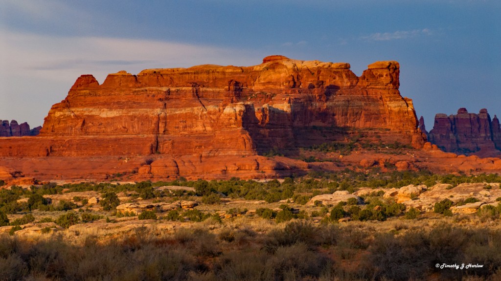
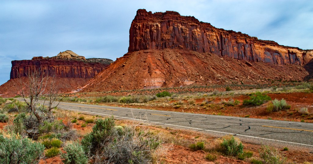
The Needles District gets its name from the sandstone spires that remain after millennia of erosion. Those spires are the remnants of Cedar Mesa Sandstone deposits that pushed violently upward about 20 million years ago due to tectonic activities. You can learn much more about the geography of Canyonlands at this link: https://www.nps.gov/articles/cany-needles.htm
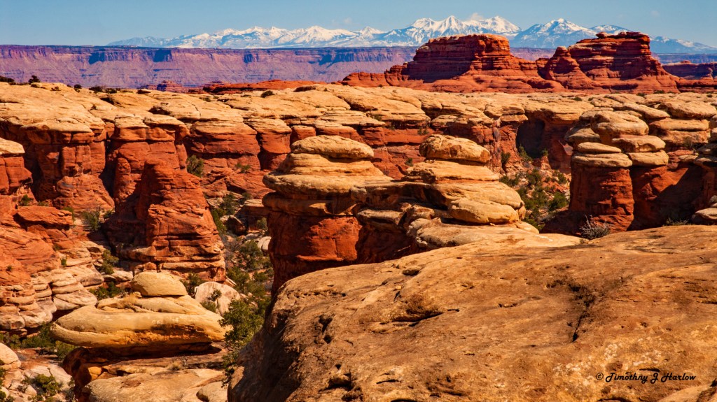
The Chesler Park trail takes off from the same starting point as the famous 4 wheel drive trail known as Elephant Hill, and like Elephant Hill it goes straight up to a high plateau. The beginning of the trail is quite steep as it ascends rapidly from the parking lot, but soon you are greeted with an incredible vista.

You can see that the top sandstone layer is a chalkish white color with the deep reds down below. The red sandstone is high in iron content. Once you are up on the plateau, the trail levels out a bit, and you begin to get into some very cool scenery.

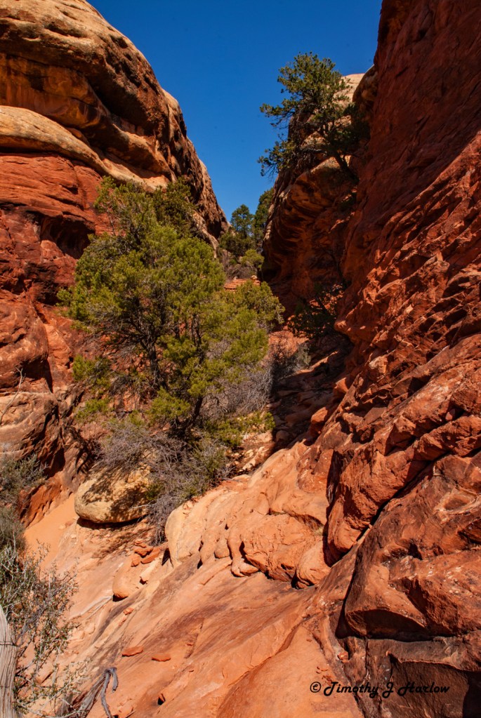
The trail soon heads back downward through some fairly narrow slots in the rock as it descends toward Chesler Park, the Devil’s Kitchen and more awe inspiring scenery.
I make sometimes make slow progress on the trail as I am constantly finding new things to photograph. I can spend hours in a quarter mile area just exploring, looking for that perfect “shot”. Here is an interesting formation that I call “the Blob”.
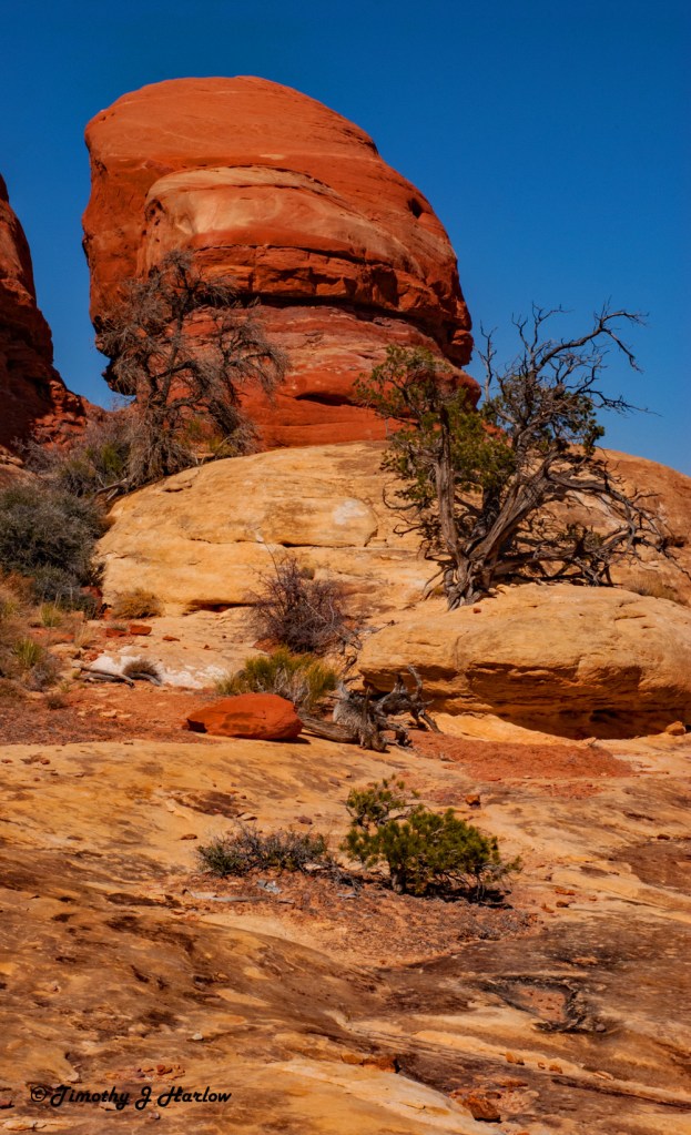
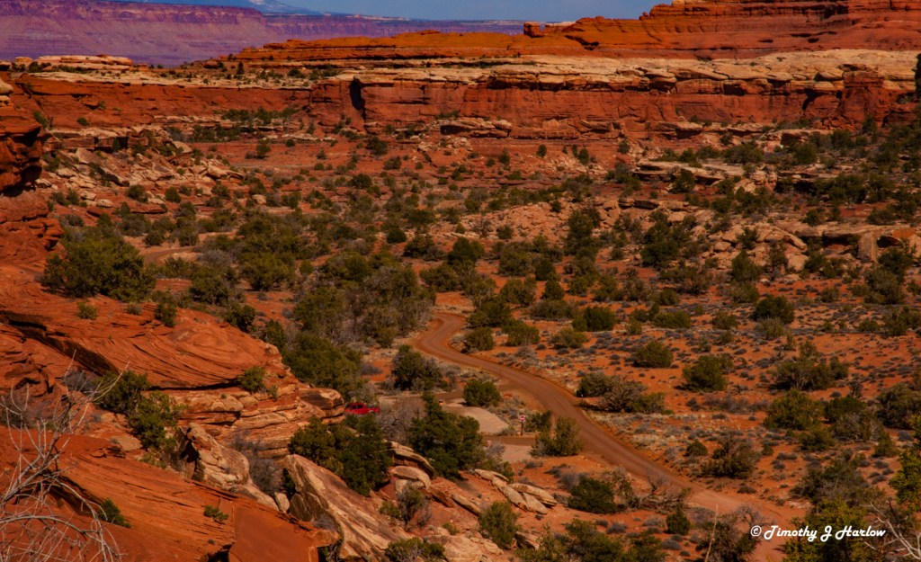
One thing that always amazes me is how the juniper and cedar trees find places to take root and grow in this harsh environment with so little soil. The high desert climate yields hot summers with cool/cold nights. Winters are cold with sub-freezing nights, and sometimes days are sub-freezing as well. But most winter days are quite pleasant. Precipitation is sparse, but flash floods are common in the spring, summer or fall. The red rock country is quite striking when covered in snow too.

If you’re looking for a remote park that’s got easy access with nice dark skies, plenty of hiking options and incredible scenery, then you really might want to check out Canyonland Needles District.
I hope you have enjoyed my little photo tour of Canyonlands Needles District. Have a wonderful day, and stay safe out there. We are still a long way from normal, but it is at least in sight.


Such excellent photos! Canyonlands is one of my favorite National Parks. I’ve been twice, one of the times we got caught up in a freak blizzard that moved through in the middle of May. Sure made for an interesting hike in an area where steep drop offs can send you plummeting to your death lol!
LikeLiked by 1 person
Oh yes, M.B.! When the “slickrock” gets wet, it is really slick. Have you been to Needles, or other sections of the park? And have you posted about your trips there, because I’d love to read about your experiences? I love your writing. The high desert is so interesting, and we literally do get just about any type of weather. One time I got snowed on in Salt Lake at a 4th of July fireworks show in Liberty Park. Of course it didn’t stick, but it was interesting. Have a great day!
LikeLiked by 1 person
Your very nice words about my writing are an excellent way to kick off Monday, thank you! 🙂 I haven’t written about my experiences in these parks (I have been to several state parks and all the national parks in Utah – including Needles!) but I do have some photographs you can check out at this link:
https://mb-henry.com/photography/utahphotos/
And sometime I really should write them up! And glad to know I’m not alone with wild weather experiences in Utah 🙂
LikeLiked by 1 person
M.B. I just checked out your photos of Utah. You have some sweet stuff. I really like your work. Thank you for sharing, and yes, you should do a few posts about Utah’s parks.
By the way, have you ever been to the Maze section of Canyonlands? It is on the western side of the Colorado River. I want to go one of these days, but it is so remote. I would feel better about going with a friend in case something happened.
LikeLiked by 1 person
I have not been there but would love to go! We are by no means finished with Utah, so hopefully one of these days 🙂 I’m so, so glad you enjoyed the photos. It’s hard to get bad pictures in Utah.
LikeLiked by 1 person
I’ve been to Bryce Canyon and Zion in Utah, but never made it to Canyonlands. Such amazing color and natural formations.
LikeLiked by 1 person
Thanks Mitch. I have been to Zions, but never Bryce, and I live in Utah – no excuses. Canyonlands is a very cool and totally diverse place. The park is divided into a few distinct “districts”, all with very different geography. Check out that Park Service link; something might catch your interest. Have a good one!
LikeLiked by 1 person
Thanks for the tip about the Needles District. We were in Canyonlands last summer for a bit but missed this part. Hoping to go back someday. Congrats on your vaccinations!
LikeLiked by 1 person
Thank you. Glad you all enjoyed the post. Happy travels. And stay safe.
LikeLiked by 1 person