Northwest Coast Marinas and Harbors

I don’t know why, but I’ve always had a fascination with ships, marinas and harbors. This is pretty hard to explain, especially given the fact that I grew up in the west Texas desert of El Paso. But the first time that I saw oceangoing boats and ships, I was awestruck. Take me to a coastal marina, and I can walk around for hours and hours studying the various vessels — the lines, the geometry, the colors, and the contrasting shapes.

Perhaps this is due to the engineer in me as I have always been fascinated with mathematics and geometry. Perhaps this is due to the artist in me as I love to figure out how to use various shapes, textures and colors to tell a story through a photograph. Perhaps this is due to my roots as my ancestors sailed to the New England coast from Great Britain immediately following the Mayflower. My father grew up in coastal Massachusetts and spent his high school years in Toledo on Lake Erie. Who knows, maybe the sea is in my soul.

So I have decided to put together a photo essay of the collection of images I have taken over the last several years of the various harbors and marinas that I have visited in my excursions to the Northwest coast of the United States. I will caption each photograph, but I mostly want to let the pictures tell the story. Enjoy the tour.

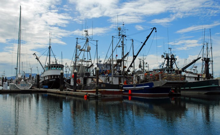
This first set of photos was taken on a trip I made to Bellingham, Washington back in the summer of 2007.

Bellingham Harbor 1 wp
Bellingham, WA commercial marina
Bellingham Harbor 3 wp
Looking toward downtown Bellingham

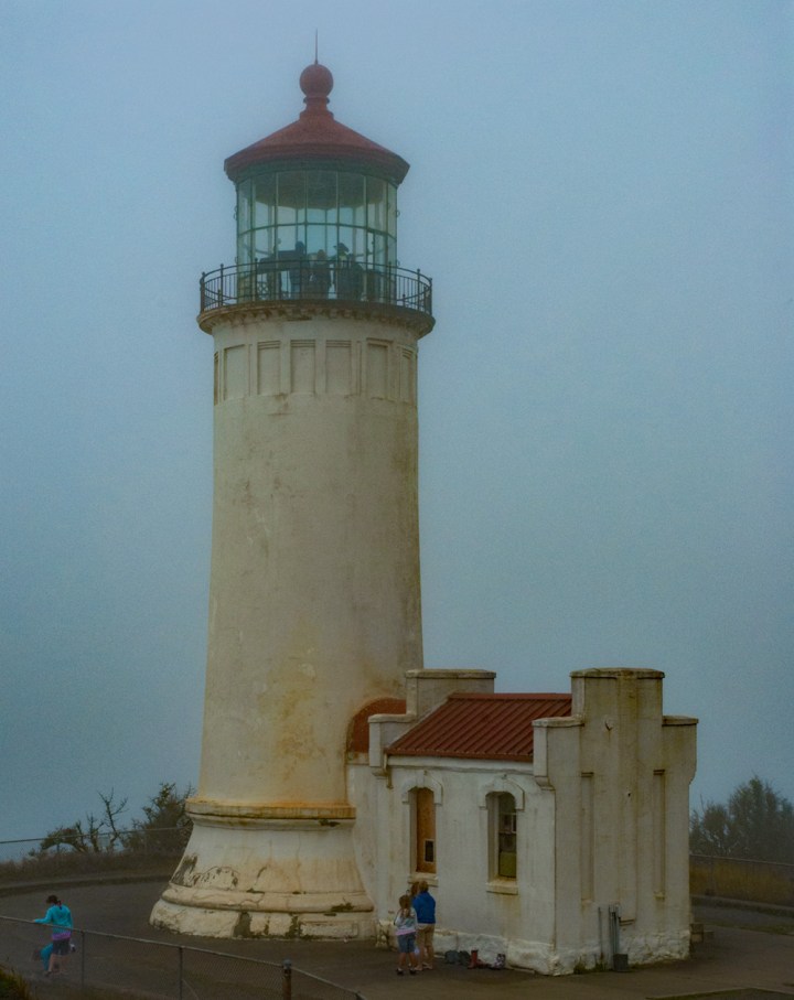
In 2008 we took a trip south out of Bellingham down along the southern Washington coast.  The weather that day was horrible, but here is a shot.

North Head Lighthouse WA wp
This is the North Head Lighthouse near Ilwaco, WA.  It is only a few miles north across the bay from the Cape Disappointment Lighthouse.  This lighthouse was built in the late 1800’s to aid navigation for ships coming into the Columbia River from the north.

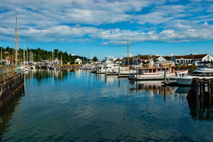
In 2009, I took my wife to Poulsbo, Washington as part of our annual trek to Bellingham and Seattle.  Poulsbo lies on the Kitsap peninsula, and is the main point of access to the Olympic peninsula.  Poulsbo is a very charming little town, and if you are a boat person, this is the place to be.  It is easy access to Puget Sound as well as an easy journey up the Hood Canal out to the open ocean.  These photos were taken in the late afternoon.

Poulsbo Sail Harbor wp
This is looking toward the Poulsbo marina for sailboats.
Poulsbo Harbor 1wp
Looking toward downtown Poulsbo from the marina.
Poulsbo Boats 2c wp
This was next to our waterfront restaurant.  I really liked the play of the colors and shapes in the late afternoon light.

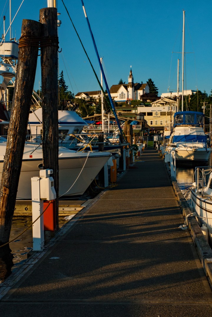
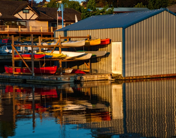
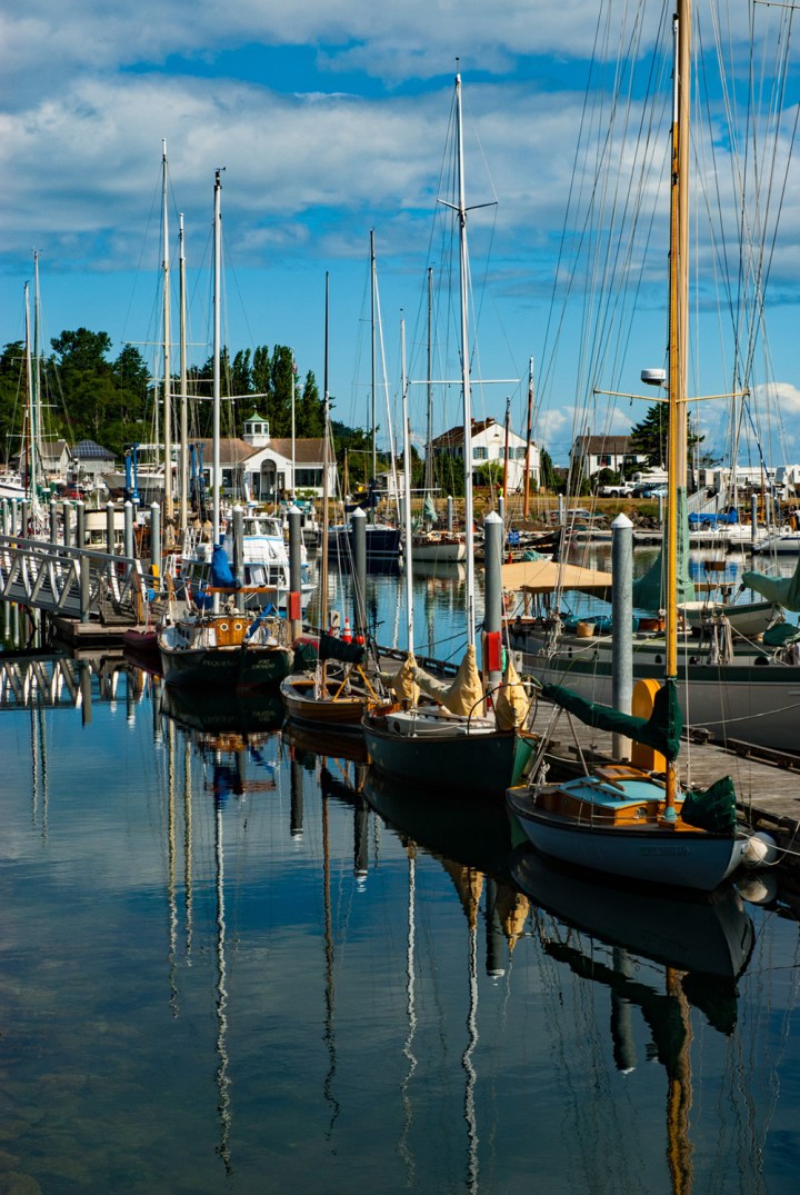
In 2011 I was able to spend some considerable time photographing the areas around Port Townsend, Washington.  Port Townsend lies at the northeastern end of the Olympic Peninsula.  It was of major strategic importance at the end of the 1800’s up into the mid 1900’s, and there are forts and old naval gun installations all along that part of the coast.  Port Townsend lies right at the northern mouth of the entrance toward Puget Sound.  Of all of the places I have visited over the years along the Oregon and Washington coasts, Port Townsend is my favorite spot.  The views are just breathtaking; the town is really charming, and the marinas are gorgeous.

Port Townsend Harbor 2 wp
Looking west into the Port Townsend sailboat marina.
Port Townsend Harbor 1wp
Another view of the greater marina area.
Port Townsend Harbor V1 wp
I really loved the way the colors and shapes were repeated in the clam afternoon light.
Port Townsend Harbor Ferry wp
This is the Washington State Ferry dock in Port Townsend.
Point Wilson Lighthouse 2011
Not far out of town is the Point Wilson Lighthouse which provided mariners safe passage into the harbors and bay.
Admiralty Head Lighthouse 3c wp
This is the Admiralty Head Lighthouse on Whidbey Island, Washington.  This lies directly across the channel westward from Port Townsend.  There are old naval gun emplacements on this head as well.

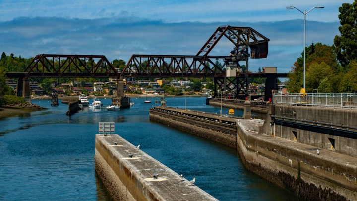
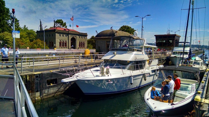
In 2015 I was lucky enough to have some time explore around Seattle between client meetings.  I had not visited the Chittenden Locks in many years, so I decided that this was the time to do it.  The Chittenden Locks were officially opened in 1917 and connect Puget Sound with Lake Union and Lake Washington in Seattle.  The locks were named after Major Hiram M Chittenden, the Chief Engineer on the project for the US Army Corps of Engineers.  Today the locks serve numerous commercial and private vessels coming into and out of the Lake Union and Puget Sound.  The lock system also contains a fish ladder enabling salmon to swim up into Lake Union from Puget Sound.

Chittenden Locks 3 wp
This is the main headquarters building for the Chittenden Lock system.  The grounds also contain a park as well as a beautiful arboretum.
Drawbridge 1 wp
Looking westward toward Puget Sound from the locks.  That bridge is a railroad drawbridge which opens when taller ship traffic is entering the lock area.
Entering the Locks 2 wp
Entering the lock system from the west – Puget Sound.  Here the drawbridge is closed allowing the trains to pass over it.
Chittenden Locks 1 wp
A few pleasure boats lining up in the actual lock.  When the lock is full enough with boats, the west gates are closed and the water level is raised the height of Lake Union.  Then the east gates are opened for the vessels to sail into the lake.
Chittenden Locks 2 wp
These boats are now lowered to sea level from the higher Lake Union side and are ready to sail out into Puget Sound.
Chittenden Locks 4 wp
Here you can see that the water level is much higher – at the level of Lake Union.  Once this lock is full, the east gates close, and the water is lowered to the level of Puget Sound.

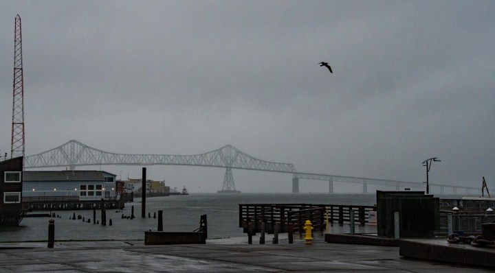
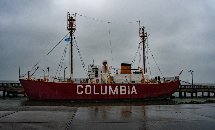
About a month ago I was in Oregon and Washington visiting my clients up there again.  I took these phtotos as I was heading up toward the Washington coast from Portland, Oregon.

Astoria Columbia Bridge wp
This is the bridge that goes across the Columbia River north from Astoria (here) up into Washington State.  The weather that day was awful — pouring rain and blowing like crazy. But I found a spot to take a few shots from the US Coast Guard Museum grounds in Astoria, Oregon.  By the way, that bridge over the Columbia River is about 3.5 miles long.  That’s about 5.6 kilometers!
Astoria Coast Guard Cutter wp
This is an active Cost Guard ship moored at the grounds.
Columbia Lightship wp
Here is a little history for you.  This is the Columbia Lightship.  Around the turn of the last century the US Lighthouse Service (which became part of the US Coast Guard) used to use lightships in areas where it was not practical to build lighthouses.  The Columbia River mouth here at Astoria is one of the most treacherous waterways in the United States.

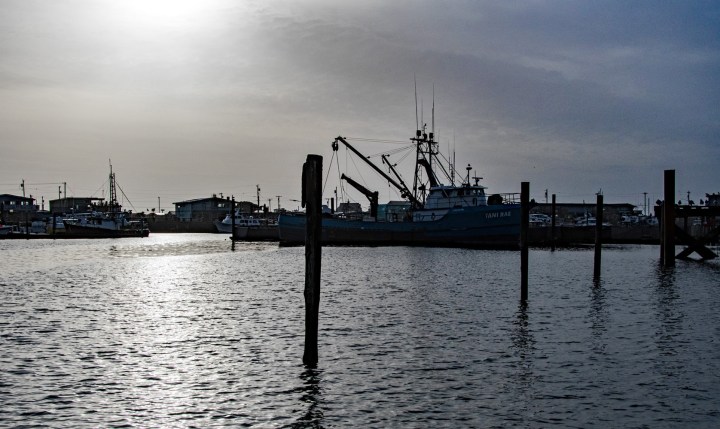
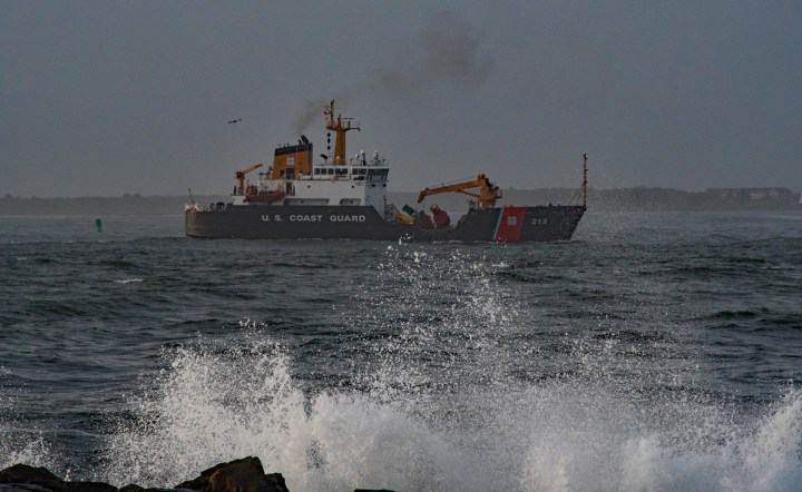
Westport, Washington lies at the mouth of Gray’s Harbor about one-third of the way north along the Washington coast.  This sleepy little town is home to the Gray’s Harbor Lighthouse as well as a very large marina for both commercial fishing vessels and pleasure craft.  The beaches here are very beautiful; much more open and less rugged than farther north up on the Olympic Peninsula.

Westport Harbor 1 wp
This is the Westport, WA marina full of commercial fishing boats.
Westport Harbor 2 wp
Another view of the marina.
Westport Harbor Sunset wp
Sunset on the Westport marina looking westward toward town.
Westport Harbor Sunset 2 wp
The building at the back of the marina is a maritime museum in Westport.
Gray's Harbor Lighthouse wp
The Gray’s Harbor Lighthouse from Westport.
Gray's Harbor Light Trees 2 wp
This is the Gray’s Harbor Light as seen from the Pacific Ocean west of town.
Coast Guard Cutter - sea wp
This Coast Guard cutter was heading into port this afternoon through the rough seas.  The huge storm from earlier in the day was just starting to clear.


One thought on “Northwest Coast Marinas and Harbors

Comments are closed.