


In June I was in Nampa, Idaho attending horse show with my wife. She shows Arabian horses, and the annual Region 4 Arabian Championships are held in Napa each June. Anyway, one day while we were there I decided to go exploring over by the Snake River to the south of Napa. There were supposed to be some ancient petroglyphs not too far from Napa down by the river in an area known as Map Rock.

The Snake River is one of the larger rivers in North America, and definitely one of the larger rivers in the western portion of the United States. The river starts high in the mountain ranges of western Wyoming. It is the largest tributary of the Columbia River, which is the largest river in North America which flows into the Pacific Ocean. The Snake River flows across southern Idaho with much of the route over ancient volcanic flows.

I’ve always been fascinated by the Snake River as it is an interesting anomaly in contrasts. Here is this beautiful, big blue river flowing through volcanic wastelands. As a side note here, those volcanic lava fields have slowly worn away in areas not far from the river, and have produced some very rich soils. Southwestern Idaho has several really good wineries as a result of this volcanic history.
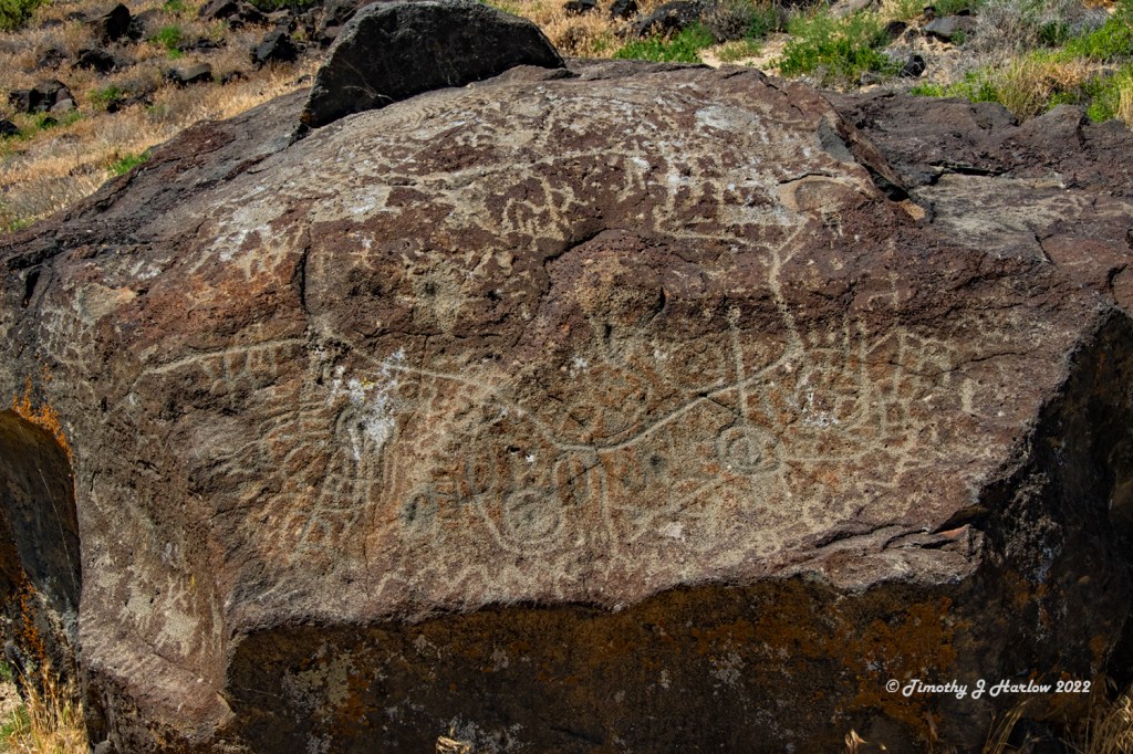
Thank goodness I had GPS on my truck as it seemed like there were about a hundred turns to get down to the river valley by Map Rock. I was expecting to see big areas of petroglyphs, something like you would see down in southern Utah or Arizona. Alas, Map Rock is just a rock containing some petroglyphs. And the rock is literally sitting right next to the road across from the Snake River.

So, I can say that Map Rock was a bit of a disappointment. However, there was a small trail, like a game trail, that went around the back of the rock and headed straight up towards the bluffs well above the road. The first part of the trail was really too steep to see if there was anything interesting up there, but I was here with nothing else to do. So up I went.
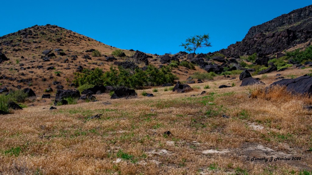
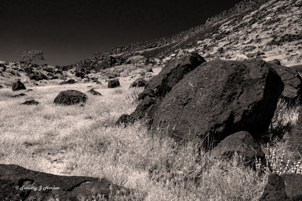
After a few hundred feet above the rock, the trail started a gradual switchback and eventually ended up on a high valley well above the road. The views up here were pretty astounding, so I was really happy that I had my camera.
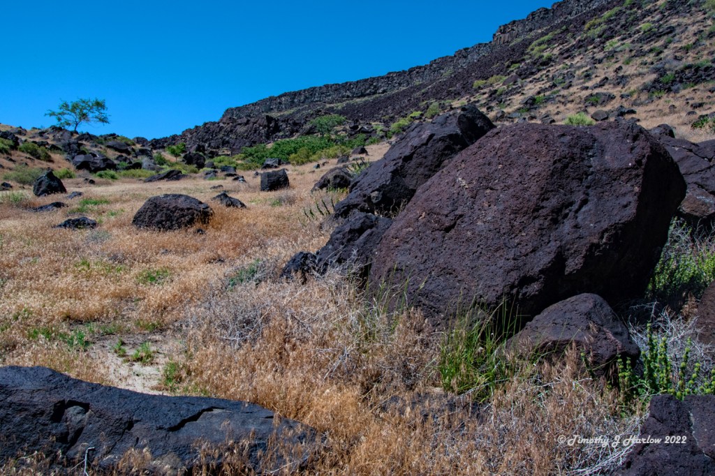
At one time this area was a nasty place to be – the middle of incredibly huge lava flows. According to the US Geological Survey, these lava flows were produced by the Yellowstone Hot Spot less than 1 million years ago. As the North American tectonic plate has moved northwest, the hot spot that is now directly under Yellowstone National Park produced these massive lava flows nearly all the way across southern Idaho. (A hot spot is a thin part of the earth’s crust with a magma dome underneath it.)
These black rocks are basalt from the massive Yellowstone hot spot flows that literally filled numerous valleys over the years. What is left behind today is a very interesting and hostile looking landscape. And on a hot day, these black basalt rocks, just add to the torment of the heat. Not far from here over in Ontario, Oregon (about 40 miles away), I have witnessed daytime summer temperatures as high as over 106°F, or 41°C!
Well, I hope you have enjoyed this little post about the Snake River, Map Rock and the southern Idaho lava flows. As always, I really appreciate you taking the time to visit my blog. Have fun out there!


Traveling really shows inquisitive minds so much about our Earth’s past and future history.
For some reason the close up of map rock didn’t come up for me, but the others did fine?
LikeLiked by 1 person
Uh oh. Not sure what happened. Thanks for letting me know. And thanks for the feedback.
LikeLike