


The winter in Utah has really dragged on this year. I have gotten a little stir crazy; it was time for a road trip. For a couple of years now I have wanted to drive out to the middle of the Great Basin in Nevada and then travel down US 93 to Las Vegas. The route is marked on several maps as being quite scenic and is a “recommended drive.” I could wait no longer; the road was calling me.
So, what is the Great Basin? The Great Basin is a region of the western United States in which all of the drainage (the rivers and streams) is all internal, in other words nothing flows out of the basin. In North America there is a geographic feature known as the Continental Divide which generally runs through the Rocky Mountains in the western half of the continent. All rivers to the east of the Divide eventually drain into the Atlantic Ocean or the Gulf of Mexico. All rivers to the west of the Divide eventually lead to the Pacific Ocean or the Gulf of California in Baja Mexico.
However, there is a large area in the western United States running from the Sierra Nevada Mountains in California east to the Wasatch Mountains of Utah in which none of the rivers drain into the Pacific. They flow into various inland seas like the Great Salt Lake in Utah or many times just into dry lake beds which only see water a few times per year. The region extends northward into southeastern Oregon and southward to not too far north of Las Vegas, Nevada over into eastern California.
The geology and topography are quite fascinating. Much of the region consists of what is known as a basin and range topography, or for the geologists out there — horsts and grabens. This part of North America has undergone violent changes over the eons as the Pacific Plate has been pushed under and literally has buckled the North American Plate — plate tectonics. Much of the region has been geologically active and there is widespread evidence of past volcanic activity.
As the plates have collided, the terrain was compressed and uplifted, and even twisted and folded. In the Great Basin there are many small tectonic faults. When one of these geologic faults releases, the surroundings area can drop many feet, forming valleys between the mountains. This is where the region gets its other name — the basin and range region. So, if one is into geology, the Great Basin has a lot to see.
Most of the Great Basin is a desert – a high desert. The bigger peaks and mountains have alpine terrain as well. Of course most of you will think of a desert as a hot and dry place, which it is – in the summer months. But in the winter, the high thin air allows temperatures to fall dramatically. And, this is part of my story now that you have a proper background.
I left my house on the morning of February 21. I drove southward down Interstate 15 until I reached US 6 in Santaquin, Utah. From there I took US 6 westward toward Delta, Utah where I had lunch.
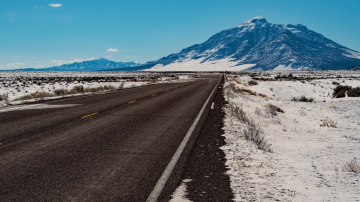
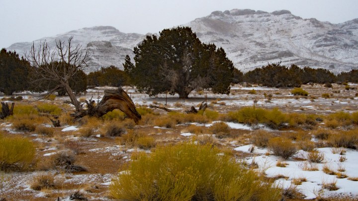
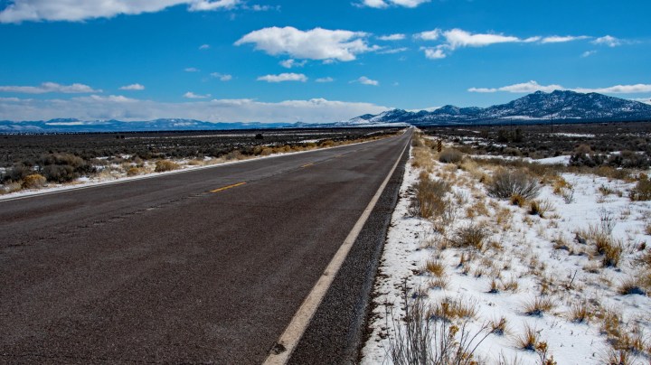
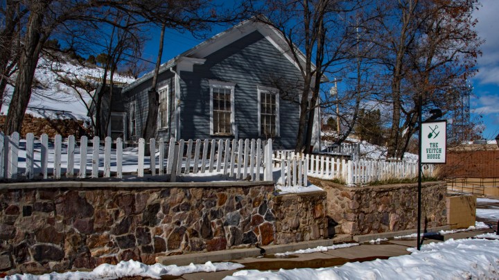
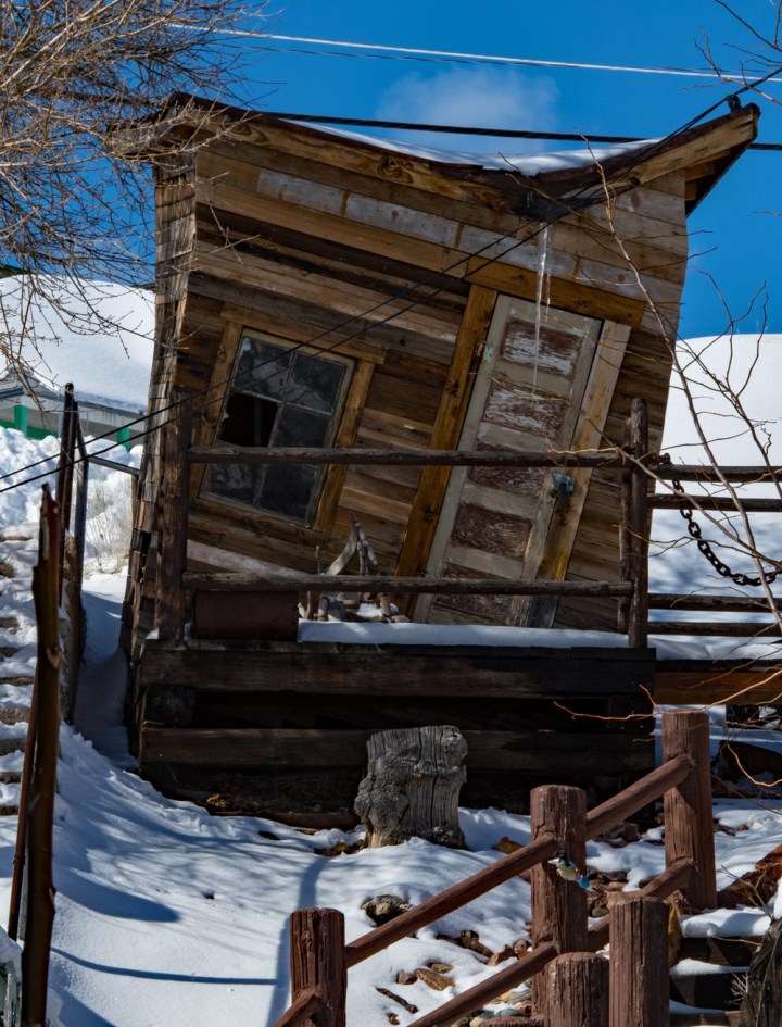
As you can see from the photo, it was a cold morning with a fair chance of snow. I pulled into a small old mining town, Eureka in Utah to stretch my legs and take a photos. The town is close to becoming a ghost town, but there has been a small mining resurgence.
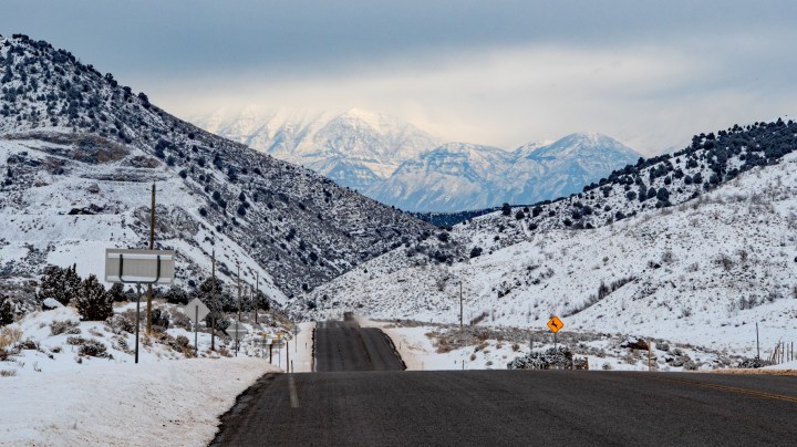
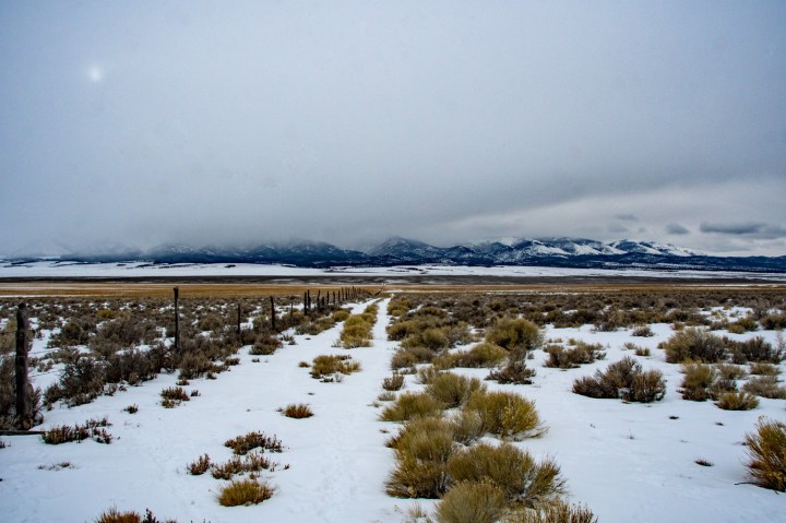
From Eureka, I continued westward to Delta, Utah, another small town in western Utah. Delta is the last real town in Utah. In fact, Delta is so remote that the military had an interment camp near there during World War II – Topaz (see my earlier post about the internment camps). After lunch in Delta the weather started to take a turn for the worse – snow. To get to my first stop for the night, Ely, Nevada, I had to cross several mountain passes.
As the afternoon wore on, the weather continued to worsen. In several areas, I had to engage 4 wheel drive in the truck. The good news is that traffic was almost non-existent. In Delta, the route becomes a merger of US 6 and US 50. This route from Delta, Utah westward to California is known as the “Loneliest Road in America”.
Down in the next valley or basin is where the road crosses into Nevada. There is a tiny Town near the Nevada side called Baker. It’s really a gas station, restaurant and tiny gambling casino. Yet, after many miles of nothing, it is a welcome stop.
Getting to Ely, Nevada requires more westward travel on US 50 across a few more passes. Ely sits at over 6400 feet (1963 meters) above sea level. The low temperature that night was 0°F (-18°C). Ely is cold! (Click on “Ely” to see my post about the historic railroad there.) It’s an old railroad and mining town.
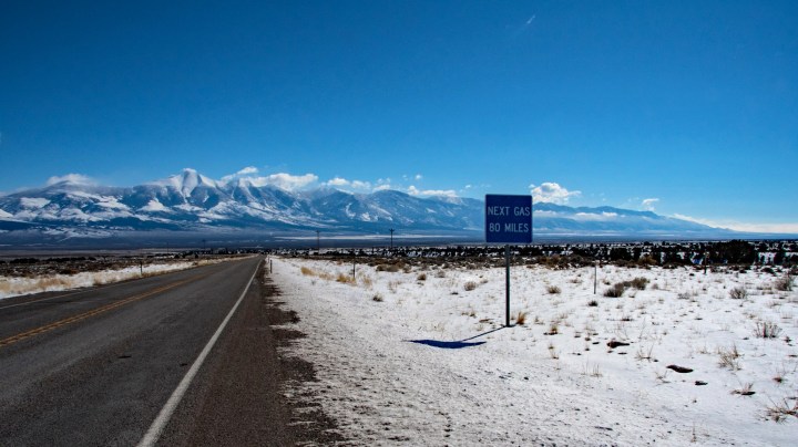
The next morning I was up and ready to begin the next leg of my Great Basin journey – south on US 93 out of Ely, Nevada to Las Vegas. Vegas was about 250 miles (402 km) away. Getting to US 93 required backtracking about 23 miles east to the intersection of US 50 and US 93. From there the route headed generally southward in a very long valley.
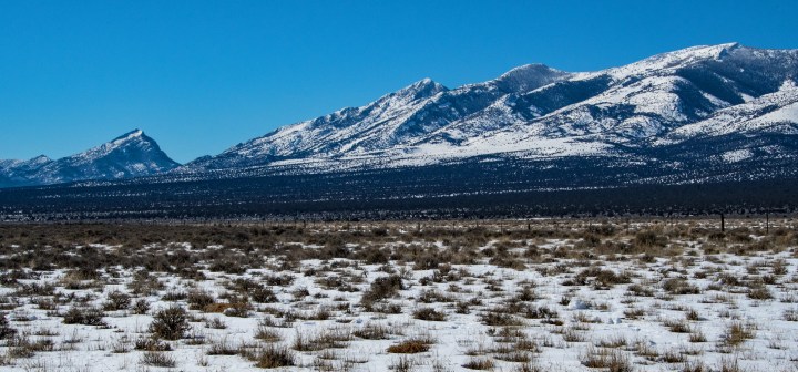
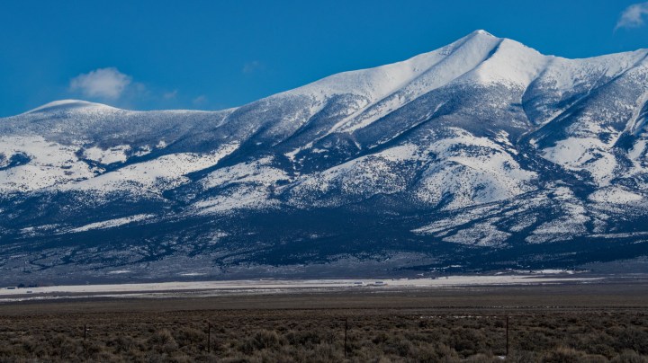
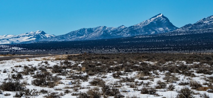
Not long after getting on US 93, the road gave a wonderful view of Wheeler Peak in the Great Basin National Park. Wheeler is the second highest peak in Nevada at 13,065 feet (3982 meters) rising over 7500 feet (2286 meters) above the valley floor. It is also home to the oldest living organisms on Earth – bristlecone pines. These trees can live over 5000 years! Back in the 1990s I was lucky enough to climb Wheeler Peak with a friend and see the bristlecone pines up close.
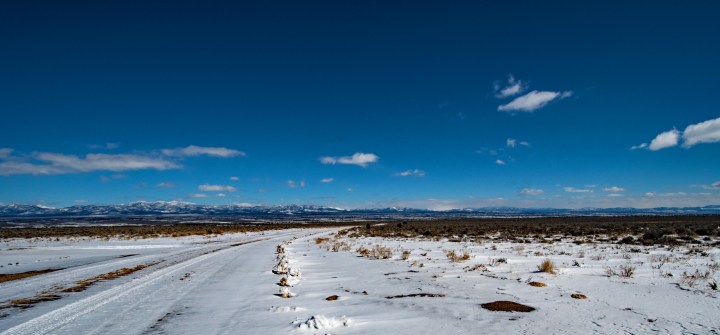
Continuing southward on US 93, I was lucky to have beautiful weather, just cold but sunny. I was rewarded with more beautiful views along the route.
More miles ticked by, and still more breathtaking views appeared. The Great Basin is immense. Over by Salt Lake City, it is so hard to get a scale of the enormity of the Basin. But out here in the clean air, the scale becomes more visible.
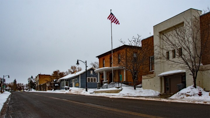
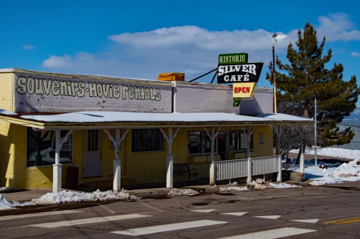
After more miles, I finally came to a very little town, Pioche, another old mining town. I found a place to eat lunch here, and then spent a little while looking around the historic old town.
After a nice lunch in Pioche and some photo opportunities, I hit the road again, still heading south on US 93 toward Las Vegas. Most people think of Las Vegas when they think of Nevada — harsh deserts, relentless heat, and of course the Strip. But Nevada is so much more. The average elevation in the state is 5500 Feet (1676 meters). The lowest elevation is in the extreme southern tip at about 479 feet (146 meters). So, as you might imagine the terrain in the state varies quite a bit. The one constant is that most of the state is a desert — high for the most part, and lower for the southern portion as the terrain gradually morphs into the terrain of Death Valley. That is the draw of the Great Basin — the variations.
As I continued my southward journey on US 93, things indeed did begin to change, albeit slowly. The temperature gradually was rising; the snow cover was becoming more sparse, and even the desert was slowly evolving. I began to see to cactus and creosote bushes — evidence of the southern American deserts. The creosote bush, or greasewood as it is sometimes called is a very hardy plant well adapted to dry conditions. It has numerous medicinal uses among the indigenous peoples.
I saw a sign marking a “Viewpoint”, and my curiosity got the best of me. This is what I found.
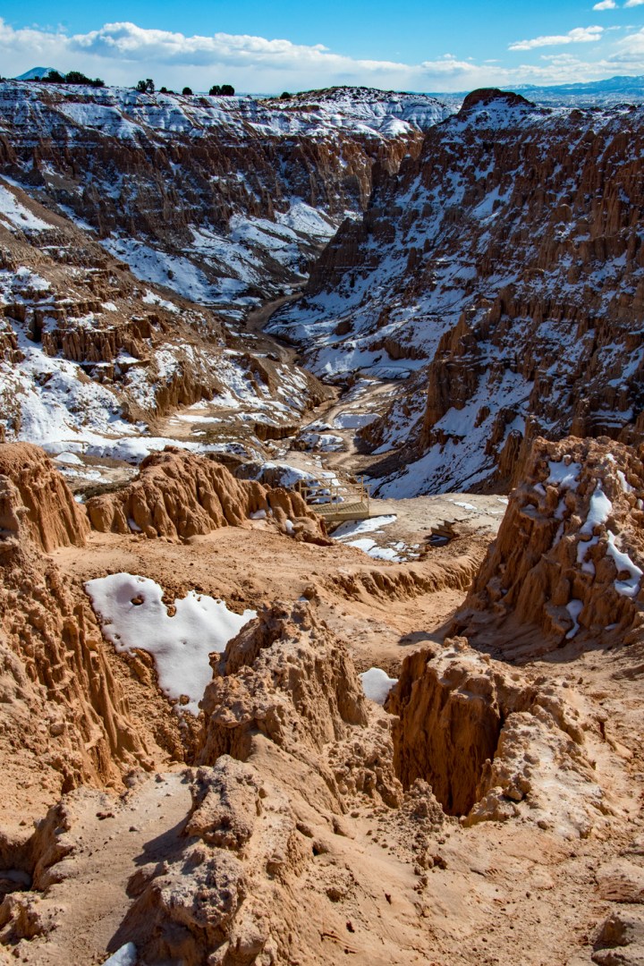
Upon spending a little time at the Viewpoint stop, I learned that Cathedral Gorge is a Nevada state park. I couple of miles down the road I saw the visitors center off to the right of the highway.
Oh well, onward I went, and my numerous stops were delaying my arrival into Las Vegas. I really preferred to get there befroe sunset. So, I continued my journey. Before too long the route, US 93 took a gradual turn westward, and I came into another interesting little town, Caliente. Caliente is Spanish for “hot”, and again things were slowly changing. I have to admit I made a big photo blunder here. As I was driving into town, I noticed that the houses were all of a similar and quite old style — all probably built around the later 1800s, and they were all occupied with few apparent add ons. I really should have stopped to take a few shots, but nature was calling, and I needed a pit stop.
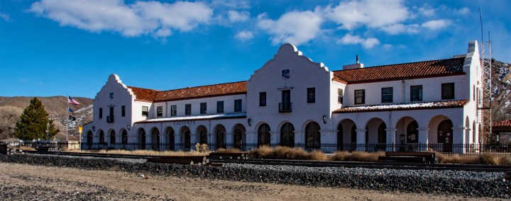
However, right around the corner from the gas station where I had stopped was another great sight — an old Union Pacific train depot. This time I got out and took a couple of photos of this historic old building.
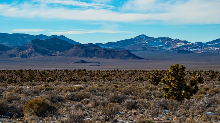
Well now refreshed with an empty bladder too, off I went and it wasn’t long before I came upon another wonderful site. Once again the desert was really changing, more quickly now. The desert was now looking more similar to my old hometown, the west Texas deserts around El Paso. However, I was quite pleased to see this sight — Joshua trees and an ancient dry lakebed in the distance. Joshua trees are really interesting cacti — sort of a cross between a cactus and a pine tree, at least in appearance. This meant I was close to Las Vegas as I was seeing my first real hint of the southern extremes of the Great Basin.
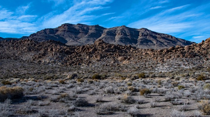
Well my journey was nearing its end, but as the road slowly began to turn southward I was lucky to come upon another interesting scene. As the sun was slowing sinking toward the west, my photography light was improving. And look what I found — evidence of ancient volcanic activity and a great peak with the light beautifully illustrating the geologic activity– the plate folding and uplifting.
After over 520 miles (837 kilometers) (from my home in north central Utah) I had arrived in North Las Vegas. My plans for the next day were to explore the Valley of Fires Nevada State Park, but that is the subject of another post. I hope you have enjoyed my virtual tour of the Great Basin. By the time I arrived back home I had traveled 1080 miles (1738 kilometers)! Lot’s of driving, and I endured sub-freezing temperatures in the northern Great Basin, snow storms and snow packed roads.
Yet I was so relaxed and refreshed at the end of my journey. I had experienced a large portion of the Basin in the winter, something few folks traveling through ever get to do. The scenery was for the most part breathtaking, and always interesting. And I had experienced several cultures too.
I really hope you have enjoyed my tour of the Basin, and I hope I didn’t bore anyone with the long narrative. As always, thanks so much for taking the time to stop by. I so appreciate all of my readers and followers. Until next time,
Tim Harlow


Your route is truly stunning, and one of our favorite areas to adventure in. We’re now near New Orleans, and will drop our Airstream at a friend’s house to circuit the US on train for a change of pace. Hope all is well! Keep practicing the arts. Best
On Sun, Mar 3, 2019, 5:46 PM Tim’s Viewpoints & Visuals wrote:
> Tim Harlow posted: “The winter in Utah has really dragged on this year. I > have gotten a little stir crazy; it was time for a road trip. For a couple > of years now I have wanted to drive out to the middle of the Great Basin in > Nevada and then travel down US 93 to Las Vegas. Th” >
LikeLiked by 1 person
Thanks Ben! New Orleans! Sounds a lot warmer than here. A round the US train trip sounds incredible. Have a blast, and I sure hope to see a few posts about that trip. Thanks again for the kind words, and safe and happy travels. 🙂
LikeLike