


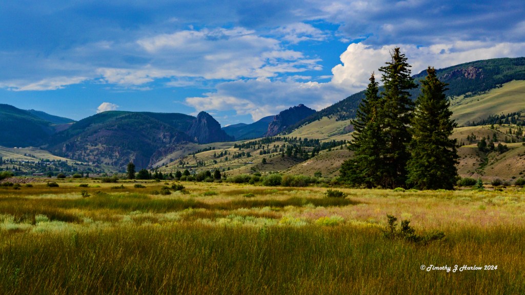
At the beginning of this month, I drive over to Creede, Colorado to visit my high school best friend. Creede is a tiny town in southern Colorado about 64 miles (104 km) northeast of Pagosa Springs, if that helps. It is an old mining town dating back to the mid 1800s. I had never even heard of it prior to arranging to meet David (my friend).
The Journey
David and his wife, Colleen, live a bit north of the greater Houston, Texas metro area in a town called Conroe. But they were visiting and staying in Creede for about 6 weeks or so. The drive from my place in Utah is about 480 miles (772 km) via a traditional route that ends up going through Moab, Utah then into extreme southwestern Colorado via Cortez, Durango and then Pagosa Springs and northeast to Creede via a small state road.
I didn’t think I’d ever get there, however. Prior to leaving, I was doing some research on Google Maps, and found that it was faster and closer to take Interstate 70 east into Grand Junction, Colorado, then cut southeast over to Creede Via US 50, then Colorado Route 149. (Don’t go this way if you are interested in going to Creede.)
Not long after I had passed the cutoff on I-70 toward Moab, my car’s GPS told me that there was a route blockage on US 50. I thought maybe it was a wreck or something, and decided to keep going Grand Junction. After getting lunch there, I headed down US 50 toward Montrose, and eventually (so I was hoping) on to Creede. The blockage was gone after lunch, so I thought all was going according to plan.
Nope, nope, nope!! The route blockage alert came back!. I learned that some bridge across US 50 was cracked, and that the road was closed except for two times per day, when the Colorado Highway Patrol would let single vehicles through. Evidently the road had been this way for quite some time. Thanks a whole lot, Google!
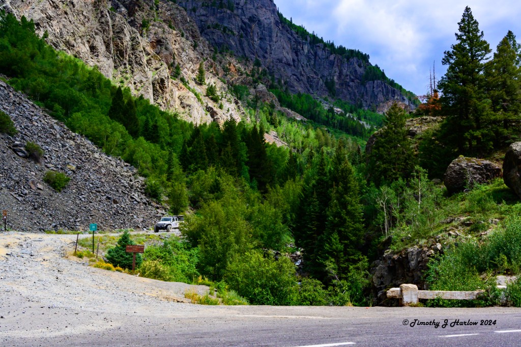
I realized that the only alternate route was to get on US 550 in Montrose, Colorado, and then proceed south on US 550 to Durango, Colorado, then east again to Pagosa Springs and up to Creede. Well, US 550 crosses the spine of the San Juan Mountains in southwestern Colorado. This route has another name that you may have heard mentioned in travel literature about Colorado – the Million Dollar Highway.
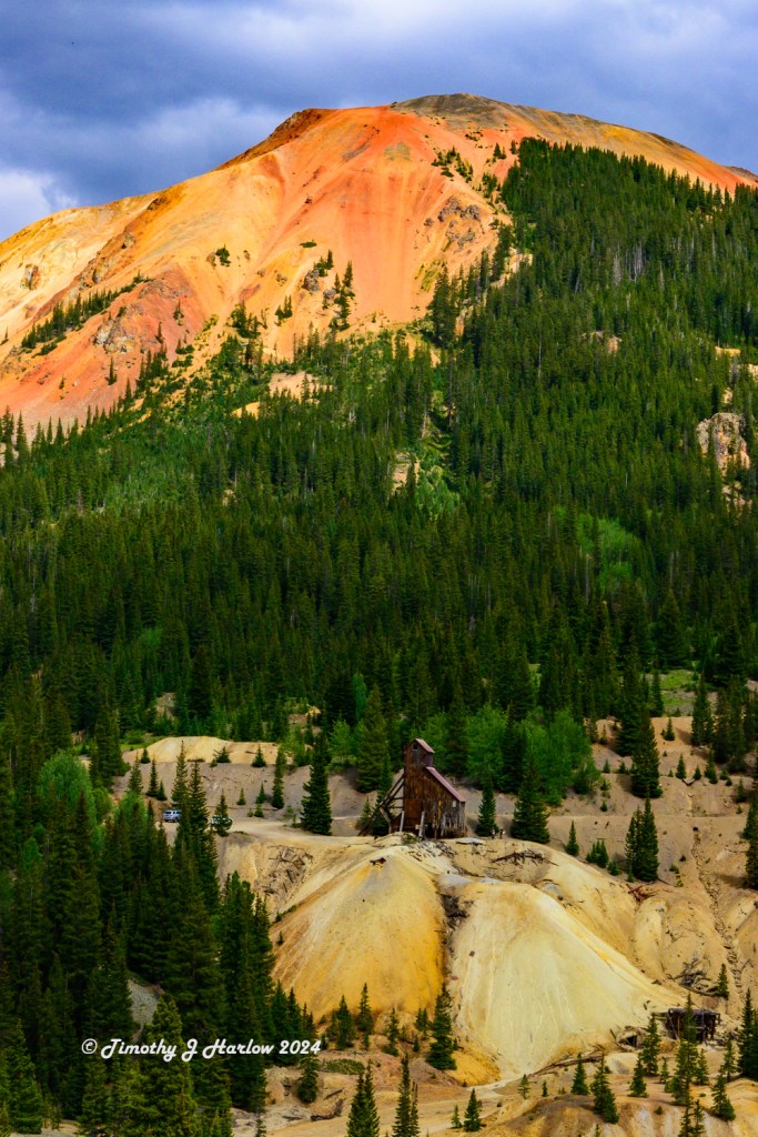
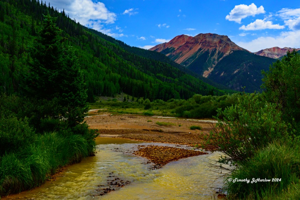
This is a famous/infamous two lane road that goes over a couple of 11,000 foot passes with 1000 foot plus drop offs, and no shoulders. The only thing between you and death at the bottom of a 1000 foot gorge is your driving skills and good luck. The route goes through Ouray, a small mining town not too far south of Montrose. Then it stretches across the spine of the San Juan Mountains to Silverton, Colorado, another cool old mining town at about 11,000 feet (3353 meters), and then onto Durango, Colorado after crossing yet another 11,000 foot pass.
The scenery here is absolutely breathtaking – when you dare take your eyes off the road for a brief moment. The good news is that there are numerous pull out spots for viewing, getting your breath back, and prying your fingers off the steering wheel!
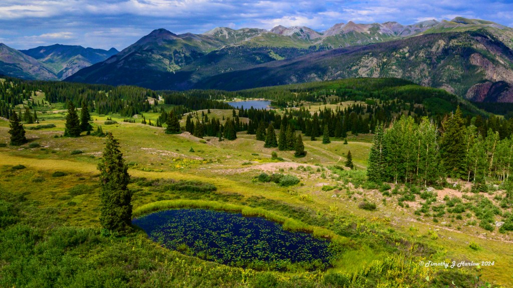
No, in all seriousness, this route is just amazing! But it’s slow; many places have 25 mile per hour speed (40 kph) limits with 10 (16 kph) to 15 mph curves. This detour added about 100 miles to the trip, and over 3 extra hours. But the views were absolutely incredible!
Things started looking up timewise once I got to Durango, and then onward to Pagosa Springs, Colorado. I only had one more big mountain pass to cross between Pagosa Springs and Creede. That one one is Wolf Creek Pass at about 10,750 feet!
Let’s just say that I didn’t adhere to the recommended speed limits on the curves between Silverton and Creede. But I did encounter one more stoppage. Only a few miles from Wolf Creek Pass the road crosses a small bridge, and there was traffic stopped with police cars this side of the bridge. I gather a tractor-trailer rig must have lost its trailer brakes coming down the pass as the trailer was on fire!
After about 30 minutes, they let us all through. The back end of the trailer was melted; the tires were gone and the wheels were partially melted! So, from that point onward, I was really pushing the speed on the curves in my Audi S3.
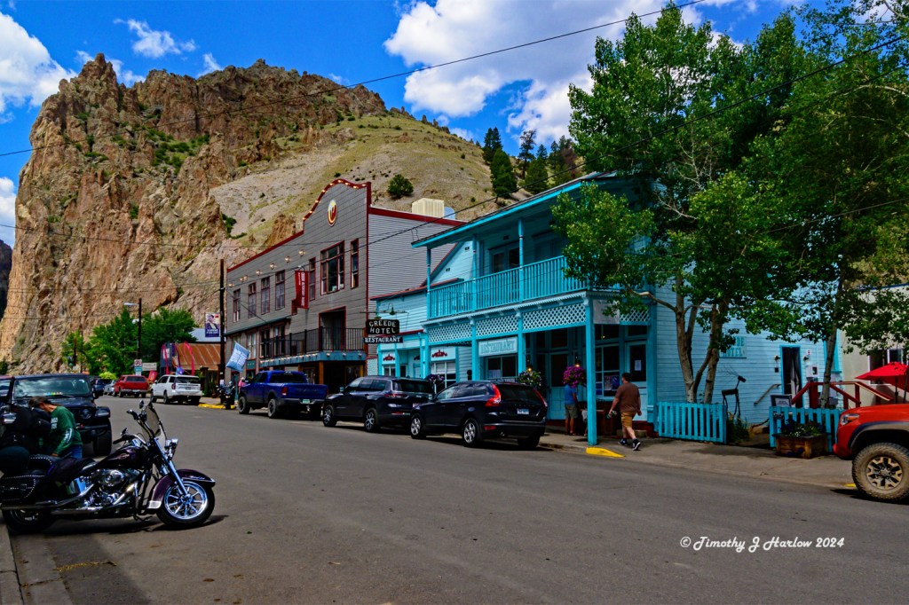
My friend David and his wife, Colleen, were awesome and had some dinner waiting for me when I got in a just a few minutes after 8 pm. So, the next day we did a bit of exploring around Creede and had a nice lunch at the Creede Hotel.
Creede
Creede was a big mining town in the mid to later 1800s. There was some gold produced here too, but most of the mining was for silver. The town prospered with numerous saloons and gambling houses. Bat Masterson was here as was Robert Ford, the man who killed the outlaw, Jesse James. Creede’s population boomed up to about 10,000 people until the silver crash of 1893. The town never went to complete ghost town status, but today its population is only about 257 as of the 2020 United States Census.
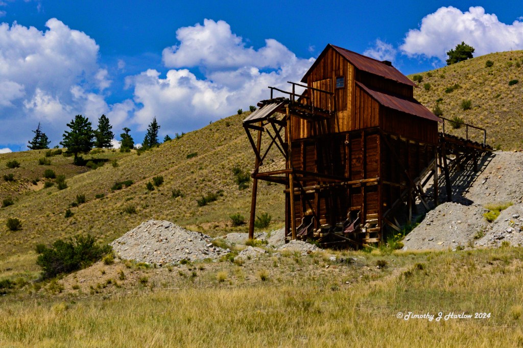
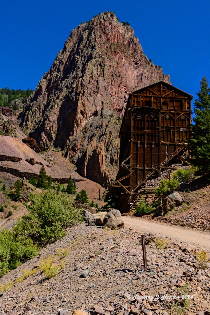
Creede did have active mining until the mid 1980s, but most of the mining in the 1900s was for lead, zinc and copper. Creede was connected to many of the southern Colorado towns via the Denver and Rio Grande Railroad. A remnant of this railroad is the Durango to Silverton Narrow Gauge Railroad which is now a famous tourist attraction offering steam train rides between Durango, Colorado and Silverton.
The town was named after a Nicholas C. Creede who founded the Holy Moses Mine near the town. The mine was quite prosperous, and that eventually led to a huge amethyst strike there as well. Nicholas (Nic) became so prosperous that the mining camp was named after him, becoming the town of Creede.
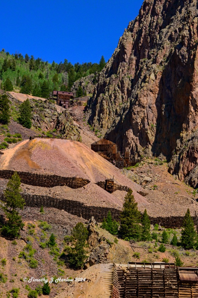
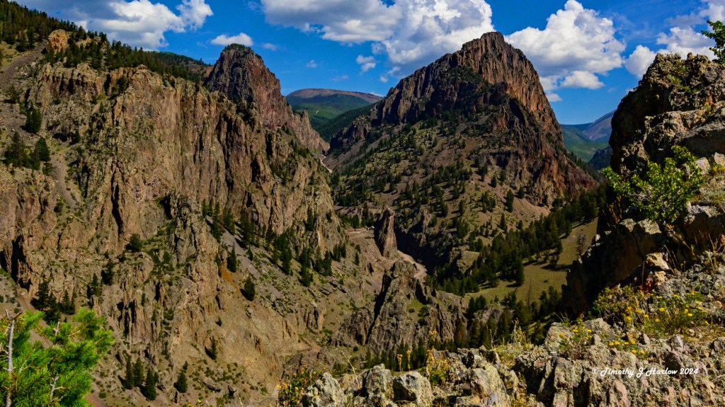
David and I had an awesome breakfast Saturday at a small café called MJ’s in Creede. Then we took David’s truck (a 4 wheel drive F350) up a long 4 wheel drive road called the Bachelor Loop. It heads up into the mining country to the north of Creede. Again, the scenery was astounding.
Bachelor Loop
We ended up meeting a couple of guys that were touring the Colorado San Juan Mountains on off-road motorcycles, and spent a good amount of time chatting with these guys. They told us that there is a 4 wheel drive road that goes up into the 14,000 foot peaks between Creede and Silverton. (Sounds interesting!)
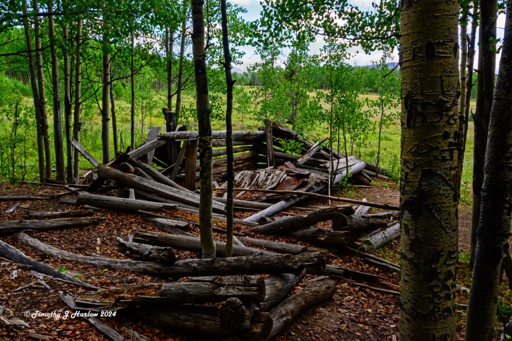
Well into our drive we found an interesting historical marker about another mining town called Bachelor City. This city was larger than Creede and located up in a high mountain meadow. At one point the town had numerous saloons, gambling houses and of course prostitutes. David and I hiked around the area, but only found one old broken down cabin remains. Other than the historical marker, one would never know that there had ever been a town here.
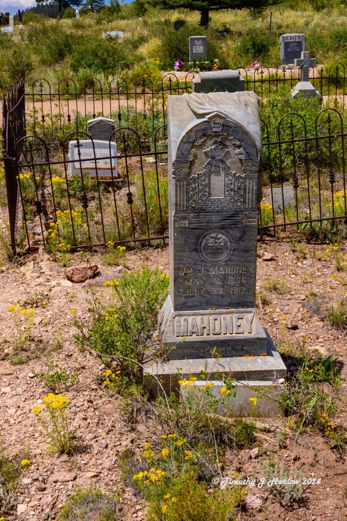
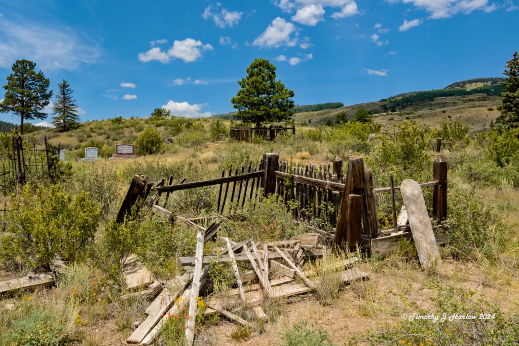
As we were nearing the end of the loop road, it came out at the Creede Cemetery. David and I walked around that for a while. I was really shocked at how many of the old graves were of young children (newborn to 2 years old) as well as so many young women in their early twenties. The old graves were mostly overgrown and neglected, so taking photos was difficult.
The Up and Over Trail
On Sunday morning, David, Colleen and I headed out for a hike that goes just east of Creede, up the mountains, and then back down into town via the first part of the Bachelor Loop road/trail. This was the first time I have hiked with anyone in a while, but it was super nice to have some company.
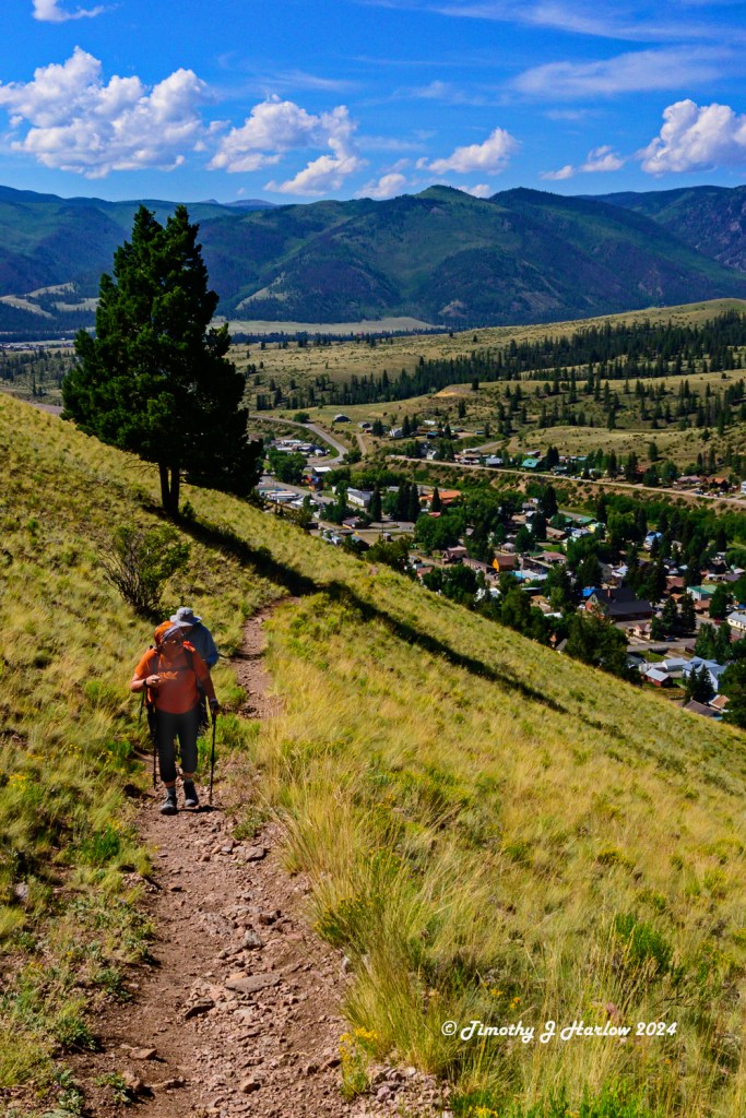
We left early as the trail has full sun exposure until the top. Even though Creede is at a pretty good altitude – 8,813 ft (2,686 m) – that summer sun still can get a bit warm. The trail out of Creede (it takes off right from downtown Creede) was quite steep, but technically fairly easy. It just takes a bit to get into the right rhythm for the steps to breaths. The views were quite beautiful, looking back across the valley and down into the town.

We got really lucky and had perfect weather with a nice little breeze that really helped cool off the back as we hiked.

Looking down into the canyon, it’s inconceivable to me how people from the 1800s could construct the mines, the buildings, the roads, and the railroads through this incredibly rugged country. That probably explains why some many of the men in the Creede Cemetery had died at such young ages.
The trail down from the top was pretty as it wound downhill through the trees. Up until the last half mile, the trail was fairly easy like the uphill section. But then we hit a bunch of rocks, and things got quite a bit more difficult. The rocks were all small, and very sharp – broken shards of granite all on a very steep talus slope. With every step some of the rocks would slide around a bit. The first two sections were not too bad, but the final section down the last part of the trail was even steeper. It had a nice, steep switchback, and the rocks were super loose here. We all made it down without any incidents, and the rest of the hike was just back to town via the Bachelor Loop road.
What a fun time we had! Creede kind of grew on me, and now I understand why David and Colleen chose this place as there get away from the intense heat and humidity of the southeast Texas summers!
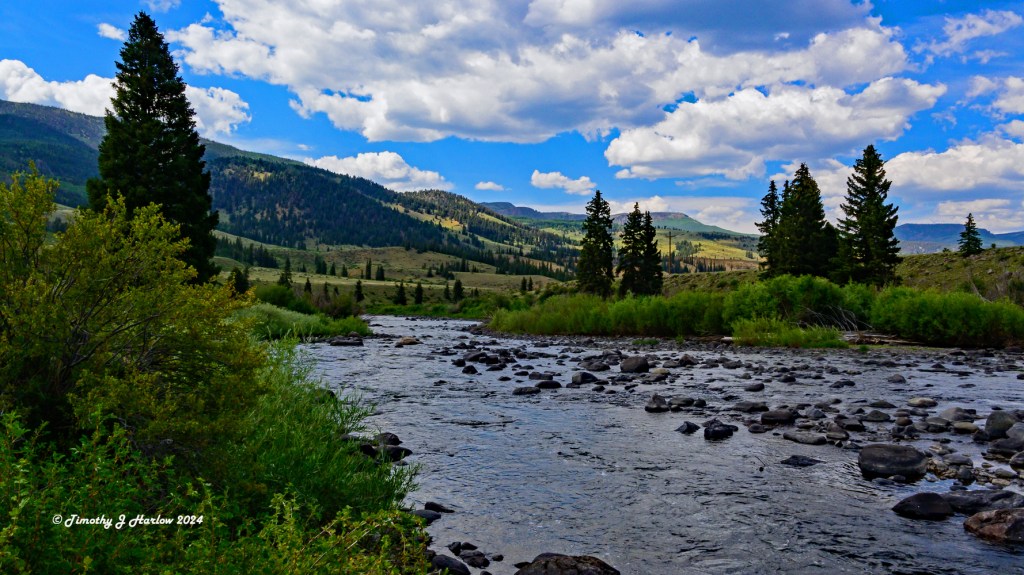
This pretty much wraps up my experiences in Creede. This little town high up in southern Colorado near the headwaters of the mighty Rio Grande River really packs in a lot of incredible scenery, history and fun recreation. I hope David and Colleen are up for more visits!
Thanks for stopping by, and I hope you enjoyed the story as much as I enjoyed the experience.


Absolutely gorgeous pics!
LikeLiked by 1 person
Thanks so much MB. I had good subject matter.
LikeLike
A marvellous photo essay, as always, Tim!
LikeLike