


On the morning of March 26, I arrived at Snow Canyon State Park in Utah to get in some good hiking while I was in the St. George area for a client meeting the next day. The previous day, I had driven from Kanab, Utah over to St. George. Along the way, I had stopped into Pipe Spring National Monument to do a bit of exploring. Utah has had a very wet winter and spring, so my Kanab plans got changed a bit.
Snow Canyon is located just on the northern end of St. George, Utah, and being a state park, the entrance fee was only $10! I had been to Snow Canyon once before, but only for a short morning stroll. So I stopped into the ranger station for some guidance and advice. The ranger was super nice, and after asking me what I wanted to do and see, he suggested some nice trails.
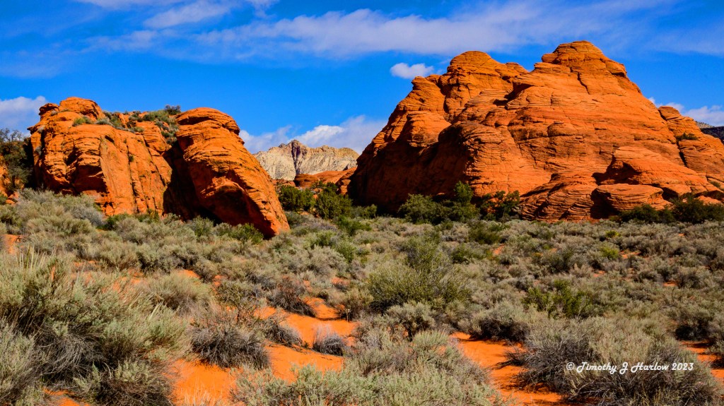
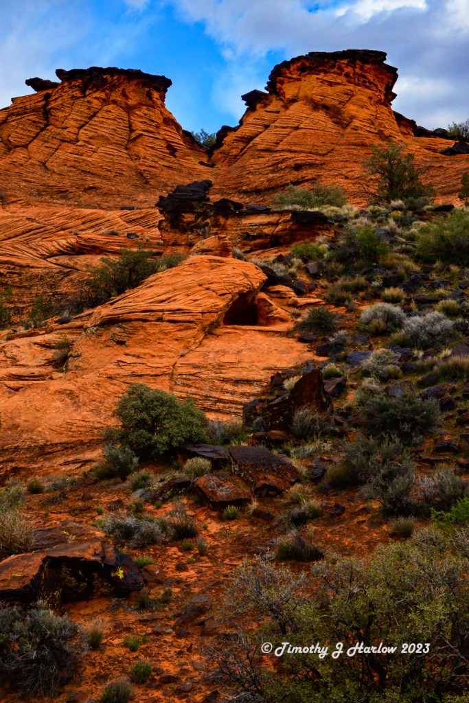
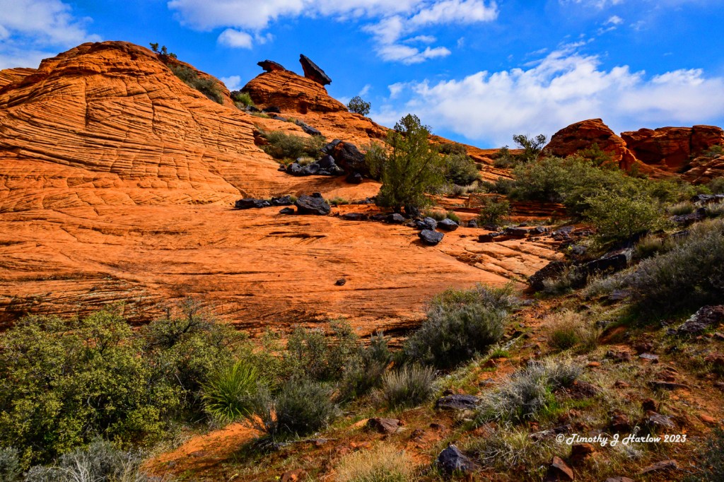
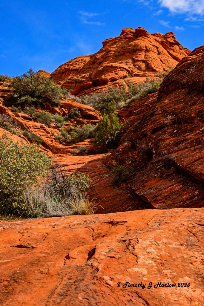
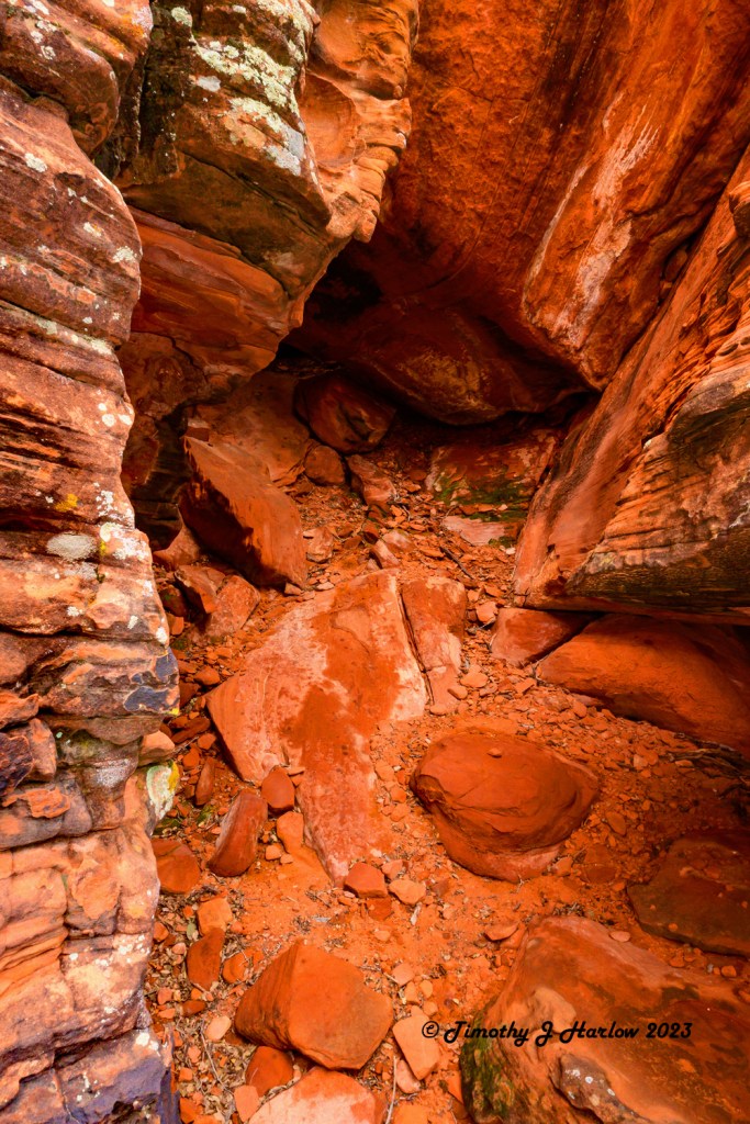
I ended up settling on Hidden Pinyon and Red Sands trails as they connected and offered a real variety of terrain and scenery. The morning was beautiful – sunny skies and very pleasant, mild temperatures. The Hidden Pinyon trail is quite rugged, especially after the first quarter to half mile as it goes up over a rise and then meanders through some rocks down into the deeper section of the canyon. There were a couple places where I had to scramble down a few rocks with about a 5 foot drop to the next section of the trail. (It’s not as tough as it sounds as there are a couple of rock steps chiseled into the larger rock face, and as long as one goes down facing the rock and using the handholds, it’s quite easy.)


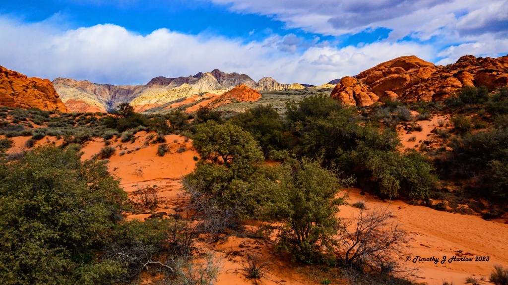
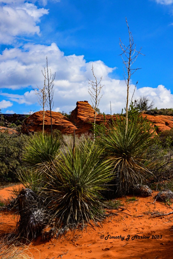
However, the scenery as you enter deeper into the canyon is absolutely breathtaking. With the heavy spring rains and wet winter, the desert was still fairly green. Compared to how wet and muddy everything was around Kanab, I just couldn’t believe how nice the trail was even after all of the rains. But, the St. George area is close to 3000 feet (914 m) lower than a lot of the area around Kanab.

I wasn’t really paying much attention to the distance as I was busy taking in the scenery and shooting a lot of photographs. This was one of the first opportunities to take a really long hike with my newer Nikon Z50 system. The Z50 is a mirrorless 3/4 format camera, so the image sensor is the same size as the one in my older D500 that I had just sold. However, I would say that the image sensor quality and overall quality of the processor is quite superior to the D500. If you saw my earlier post, Stormy Days around Kanab, you may be able to tell the difference in quality over some of my older posts that I did with the D500. (Note: all of the photos I post on WordPress are reduced image sizes to 1000 pixels at the small dimension.)
I am really beginning to love the Nikon Z50 system as the camera is very light weight compared to either my old D500 system or the new Z6ii that I purchased recently. The Z6ii is the first full frame sensor camera that I have owned since I converted to the digital format many years ago. The image quality on that camera is absolutely incredible, and I need to start using it more. But, the Z50 is so lightweight and convenient for hiking that I find I just gravitate towards that one more frequently.
Enough camera talk; let’s get back to the Snow Canyon trails. The trail system in Snow Canyon is actually quite amazing, and there are almost countless trails that are suitable for everyone. Some of the easiest ones are even paved and would be totally accessible for those who may have difficulty walking on uneven, rough terrain. Hidden Pinyon ends at a kind of crossroads with the Red Sands trail intersecting it.
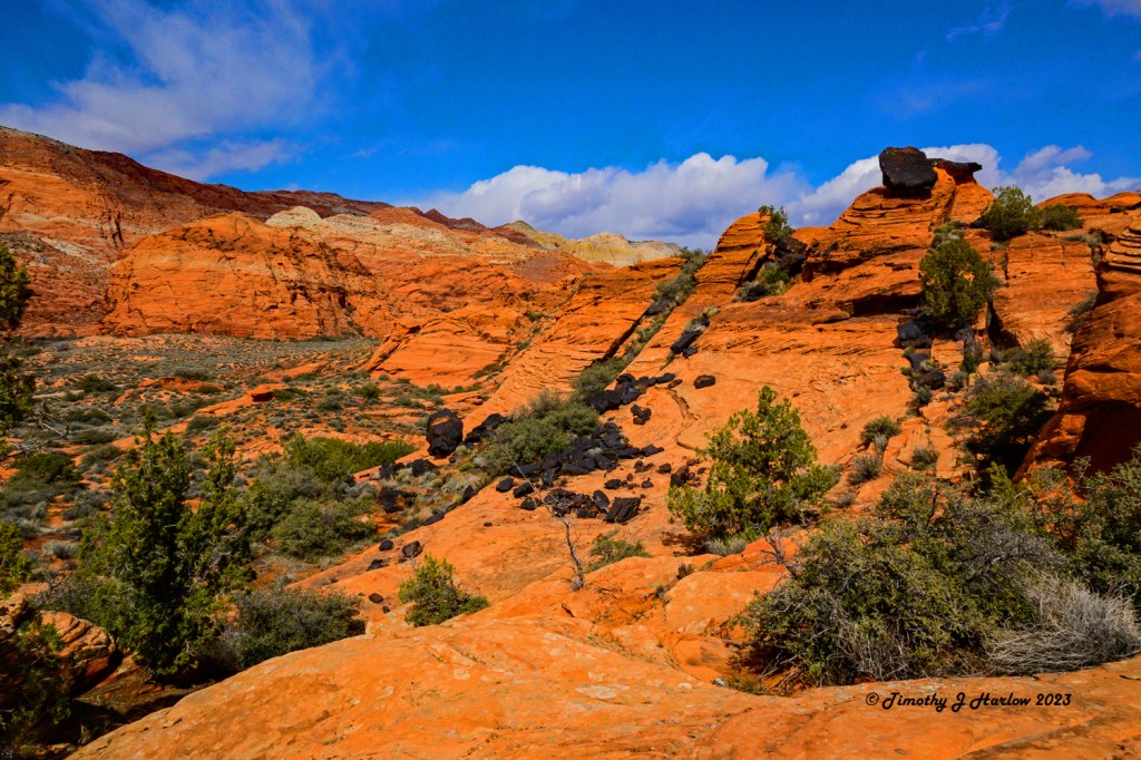
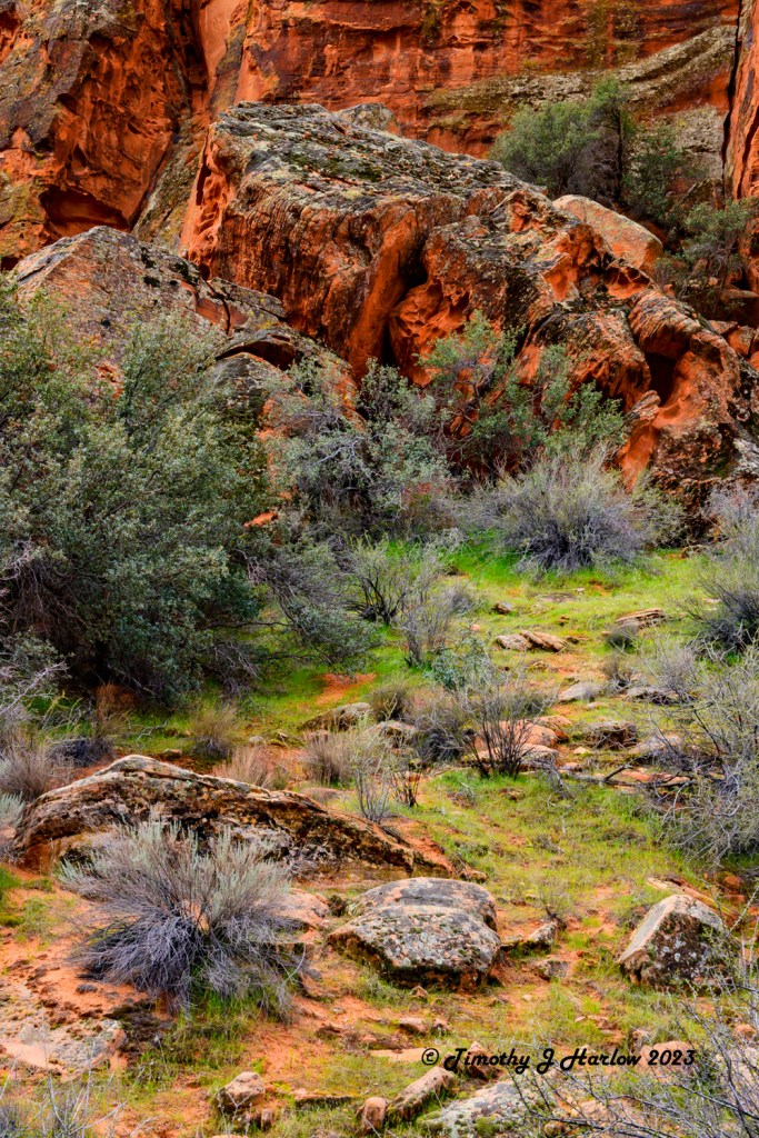
The Red Sands trail ends up going farther towards the northwest, generally over towards the Nevada border (but not that far). The trail takes off from a high point with a fairly steep descent down into yet another incredible canyon. (I kept waiting for the sand, but the beginning of the trail is quite rocky as it descends down into the canyon. 😀) Looking towards the north (I think based upon the angle of the sun) the scenery was changing more yet again. Near the top of the bluffs was a large amount of black lava rock. This made for some pretty cool photographs. I also found this interesting as I had no idea that this area had so much volcanic activity. But then again, this part of the world is not all that far from the Grand Canyon and the numerous volcanoes down in northern Arizona.
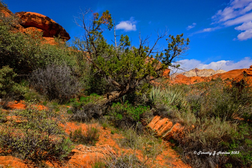
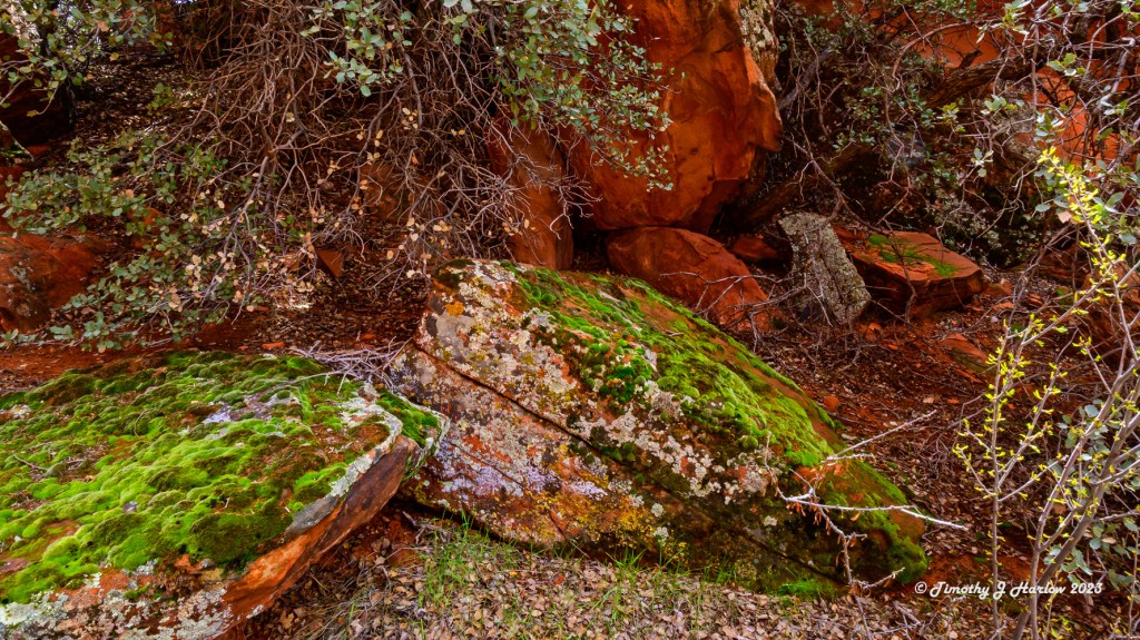
Well, as the trail descended down into the canyon I finally reached a sandy, dry creek bed, and lo and behold there was a sign showing that the trail was generally following this sandy creek bed. Aha! Now I figured out why the trail is known as the Red Sands. As I proceeded along this dry creek bed, I noticed that the sky was gradually getting more cloudy, and that some of these clouds were looking like they could potentially be holding rain. Also, my stomach told me that it was getting time for lunch. So, I found a little secluded meadow off of the south side of the trail with some nice grassy area and a few large rocks that look like they were made just to sit on. This was the perfect spot for lunch!
After getting a bite, I was looking around this little somewhat wooded area, and found a few more cool photos in here. When I was done with the photos, I got back on the trail but only went a little further ahead. The skies were definitely changing, and I decided it might be a good idea to begin heading back to get out of this creek bed before it was no longer dry.
Anyway, I finally got back to the intersection of the Red Sands trail and the hidden Pinyon trail, and decided to hike up the hills a little bit farther to the north to see what I could see. Well, I ended up with a couple more photographs, but also decided it was really time to get serious about heading back as I didn’t have any rain gear with me. I don’t think that I had been back to the truck more than 10 minutes before it started to pour. Ha ha! That’s okay as I decided I’d had enough for the day and was ready to head back, take a look at my photos and just relax for the rest of the afternoon.
That’s about it for the Snow Canyon hike. It was an absolutely incredible day, except for one small thing that I have yet to mention. Sometime while I was in the St. George area, I got COVID. Yep, I avoided that crap for all of this time, until right before my birthday. Fortunately, my client did not catch it from me. My wife started to show symptoms about 36 hours after I got home from my trip. And if I count back around 36 hours from when I started feeling some symptoms, that puts me at the ranger station in Snow Canyon that morning. Also some further good news out of this is that neither my wife nor I got very ill as we have had all of our vaccinations and took the Paxlovid medication as soon as we tested positive.

I hope that you have enjoyed the photo tour through a bit of Snow Canyon. If you are ever near southwestern Utah, it is definitely worth the $10 fee to take in this absolutely incredible scenery. The only thing I would really suggest is try and visit this area in the spring or perhaps the later fall. Not only are the summer months much more crowded, but the temperatures in southwestern Utah are generally well above 100°F, and many times above 110°F. That is not pleasant hiking.
Best wishes to you all!


That looks like an incredible place Tim.
LikeLike
A wonderful landscape, an excursion to enjoy and photograph.
LikeLiked by 1 person
Thank you!
LikeLiked by 1 person