


US 89-A The Vermilion Cliffs
My trip across the mighty Route 66 through New Mexico and Arizona is nearing its end. I have now completely left the Route 66 area and have headed north toward my home in north central Utah.
The morning I left Cameron, Arizona I was headed toward Kanab, Utah where I had a hotel reservation that evening at a Best Western. This would be my last night on the road. There are two routes to reach Kanab from Cameron. US 89 heads north from Cameron, and eventually splits about 57 miles (92 kilometers) north of Cameron at Bitter Springs, Arizona.
From here one can stay on US 89 and take that route northeast toward Page, Arizona. US 89 then crosses the Glen Canyon Dam and eventually heads northwest into Kanab, Utah. The US 89 route is quite scenic, especially the climb up to Page from the valley floor. Then one is rewarded with some nice views of Lake Powell, and then eventually not far east of Kanab is the southern end of the Escalante National Monument.

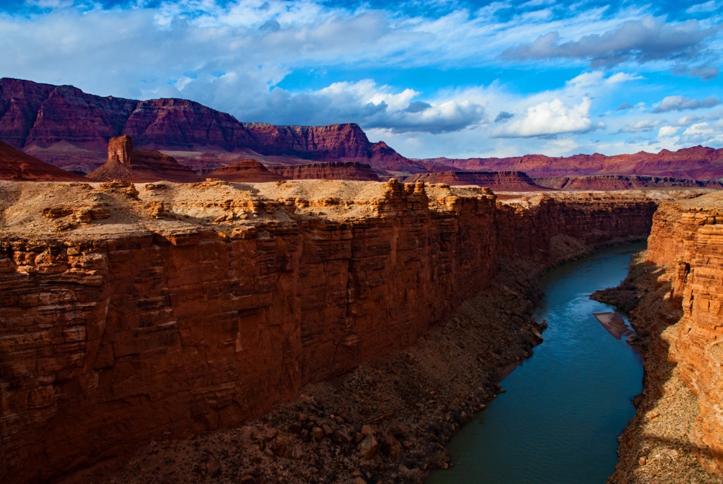
The second route splits from US 89, and is designated as US 89-A. This scenic route heads almost straight north to the Colorado River at Marble Canyon. There is an old historic bridge here at Marble Canyon along with a rest stop/visitors center and gift shop. The old bridge is known as Navajo Bridge, and it straddles the Colorado River alongside the newer one in use today. The Navajo Bridge is now a pedestrian bridge over the river.

Marble Canyon is at the far eastern edge of the actual beginning of the Grand Canyon. Even here the river gorge is quite deep. This is the route I chose to reach Kanab. After Marble Canyon the US 89-A heads back southwest and ends up skirting the southern edge of the Vermilion Cliffs National Monument.
You may or may not have heard of the Vermilion Cliffs per se, but it is likely that you outdoor/hiking oriented folks have heard of the famous feature – The Wave. It is on a trail in the more northwestern section of the Vermilion Cliffs National Monument. The Wave trail is so popular that one can only hike it after entering a lottery for a permit.

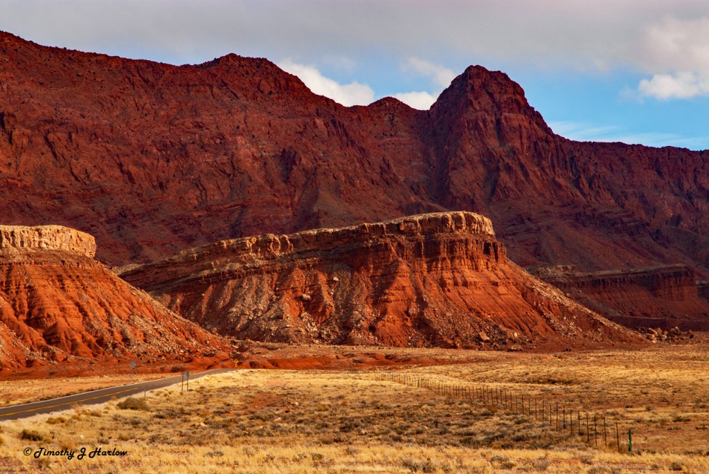
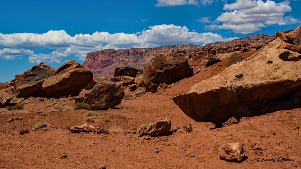
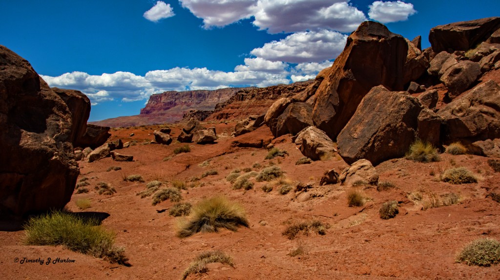
US 89-A ends up heading mostly westward along the base of the cliffs. The views are absolutely spectacular! The Vermilion Cliffs is a very primitive National Monument with no paved roads, no visitor center, and all access to the interior of the monument is via 4 wheel drive, high clearance vehicles and on foot. This place is definitely on my “go to” list. It would be a great place for me to dig out my old tent and do some real back country camping.
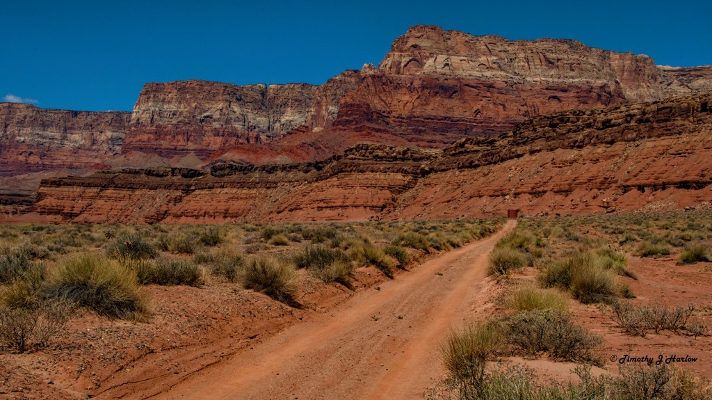
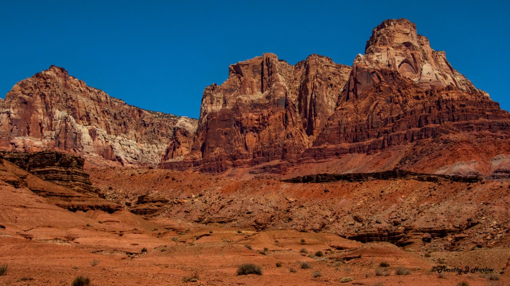
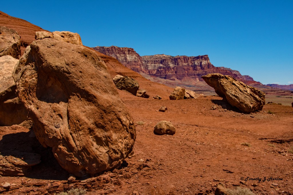
After my stop at Marble Canyon, I just drove westward along US 89-A stopping to take photographs as the scenery caught my eye. The land here is almost unbelievable. The colors are so incredibly rich, and the terrain is endlessly variable. But this is also a harsh land. The summers are brutally hot; the winters can be equally cold, and water is always in short supply. The Monument website cautions travelers to come prepared for harsh and desolate conditions.

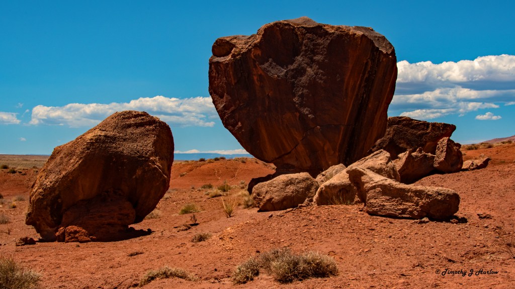
A bit farther up the road I found some really strange boulder formations with a nice big parking area. I saw some trails, grabbed my photo gear, water and food, and hit the trails. The scenery here was almost otherworldly.

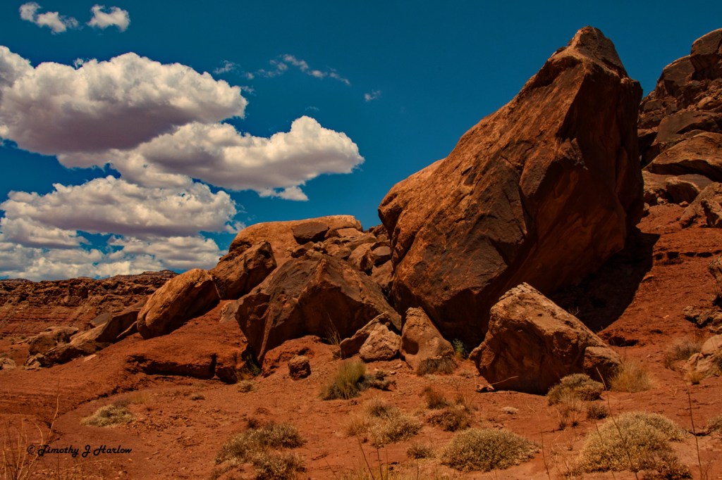
I ended up spending quite a bit of time on these trails, but I’ll bet I didn’t even hike two miles. The scenery was so captivating that I just kept stopping and taking more photographs.

While I was walking around I kept wondering how often these boulders tumble down from the cliffs above. The place is just so fascinating. I think if I could find the time, the ideal plan would be to come down with my camping trailer and make a “base camp” near Marble Canyon. Then I could pack my camping gear and tent in my truck and do some serious back country exploring. There are just so many wonderful places to see.
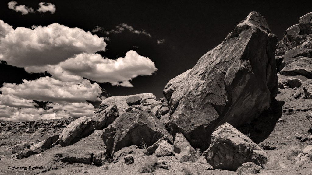
Well, I have saved the weirdest rocks for the end. I was thinking about the first Star Wars movie when I found these boulders – that scene in Star Wars IV where C3PO is out wandering the desert wastes on Tatoone before he gets picked up by the Jawas. OK, I am a total nerd.

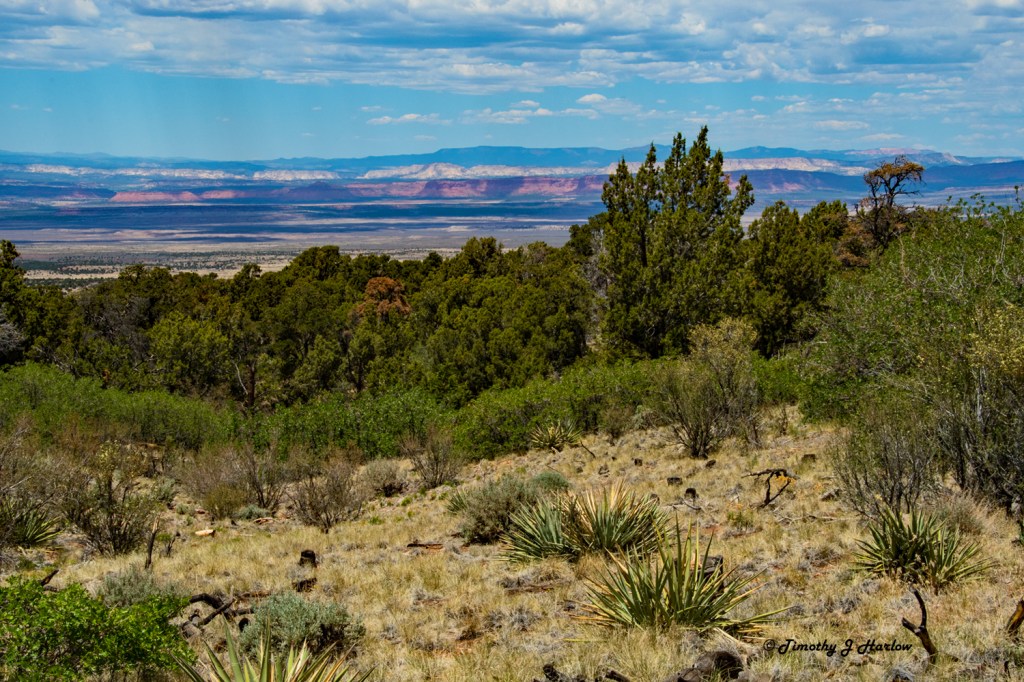
After leaving this part of the Vermilion Cliffs, I continued west on US 89-A. The trip was pretty uneventful, including the drive up to Jacobs Lake – the entrance to the north rim of the Grand Canyon. I had planned on a later lunch at Jacobs Lake, but honestly the place looked pretty seedy, and with COVID, well, I just found a nice place to pull of the highway and grab some lunch from my pack.
Well, the day’s journey was nearing its end, and the whole Route 66 trip was coming to an end as well. I had a very nice dinner at new place for me in Kanab. and then the next morning I hit the road for home.
This will be my last post in this series about a new location. I am planning on one more post as a kind of recap – the best of the trip, along with my impressions and thoughts from the journey. I will say this now, however.
WOW! What a trip! I cannot believe how much I was able to take in on this journey. And after all of those long months trapped in COVID world, well this was just so refreshing. The end was really bittersweet. I was anxious to get back home, but I was also feeling like I never wanted this adventure to end. Just being out and about exploring was so wonderful and invigorating after the long isolation of COVID. And yet as I write this Utah’s COVID cases are nearly as high as last January prior to the vaccines. So, now we are back to semi-isolation. Will there be more adventures ahead? I sure hope so.
Thank you so much for following along on this epic trip. I have so enjoyed working on these photographs and writing about my experiences. Sincerely, I hope that this has brought you some joy as well. Thanks for making this blog part of your routine, and have great days and safe and Happy Travels!


It’s a shame that the majority of the country must provide herd immunity for those refusers, unbelievers, antivaxers, and conspiracy theorists. These provide fertile ground for Covid’s morphing and continually plaguing civilization.
Thanks for this photo and journal series, Tim! This coming spring we’re adventuring and wayfaring into the Yukon and Alaska for the summer.
On Wed, Dec 8, 2021, 4:01 PM Tim’s Viewpoints & Visuals wrote:
> Tim Harlow posted: ” US 89-A The Vermilion Cliffs My trip across the > mighty Route 66 through New Mexico and Arizona is nearing its end. I have > now completely left the Route 66 area and have headed north toward my home > in north central Utah. The morning I left Cameron,” >
LikeLiked by 1 person
Very true, and very sad. Who could have for seen even 10 years ago that health per se, a virus, could have become so political? That’s as scary as the virus.
I will be excited to see and read about your northern adventures.
LikeLike