


The Land of Mordor* – Sunset Crater National Park
* Referring to the kingdom of the Dark Lord, Sauron, in the Lord of the Rings Trilogy by J.R.R. Tolkien.
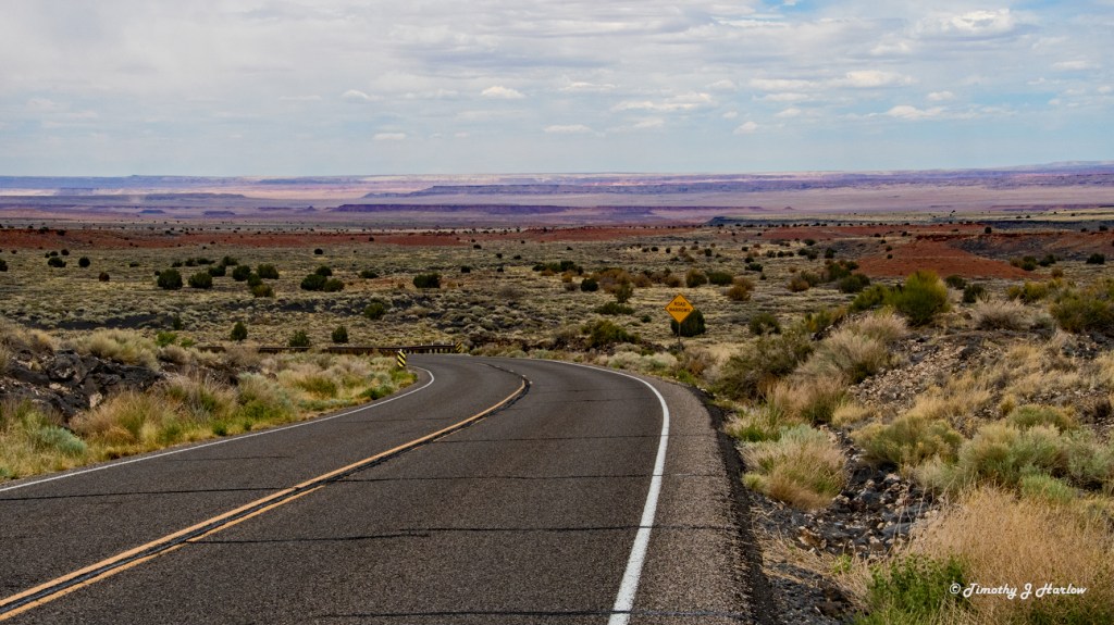
The day after I left the Meteor Crater, I proceeded westward on I-40/Route 66 to Flagstaff, Arizona, and then turned north on US 89. OK, I guess that officially ended my Route 66 journey as I was beginning the last legs of my trip toward home. However, I am including my entire trip in this series as the the journey was always about the route to, along and from that Mother Road.
About 1000 years ago the indigenous peoples inhabiting this region of what is now Arizona, just north of Flagstaff, had their lives changed forever. Sunset Crater was born in a fiery explosion spewing molten lava for many, many miles. The red rock desert landscape, nearly identical to what we see today, was covered in molten lava as far as the eye could see. Sunset Crater is only the most recent eruption in this area that has seen volcanic eruptions for over 1.6 million years. In fact according the US National Park Service, there are over 600 volcanic mountains and craters in these San Francisco Mountains near Flagstaff.

Imagine living here 1000 years ago amidst the fiery, molten lava that now covers this landscape as rugged lava rock. Many of these people were likely forced to leave their homes and relocate; it is likely that at least some lost their lives in this land that was instantly transformed into Hades on Earth. But this eruption also brought some positive changes to these peoples lives. The volcano added many nutrients to these desert soils, helping the native farmers to grow more healthy and rigorous crops.
Why did I stop here?
Sunset Crater Volcano National Monument is only about 16 miles from I-40/Route 66 in Flagstaff. Take the US 89 exit, and the monument entrance is well marked. When I was kid, maybe around 10 or so, my parents took me on a road trip vacation to see the Grand Canyon, then eventually to Yellowstone, although we never made it to Yellowstone – long story for another post. Sunset Crater was on the way to the Grand Canyon from our home in El Paso, Texas. My Dad was always fascinated with native American history and geology, so here we were.

If I recall correctly, we hiked to the top of Sunset Crater. That trail, and all trails up to the crater, are now closed to the public. As I was eating my lunch near the monument Visitors Center, a park ranger told me that the trail was closed clear back around 1973 as the trail traffic was beginning to erode the crater. So, I guess I was a lucky boy. Anyway, I have wanted to return to do more exploring.

What’s interesting about the southwestern US, especially this area around New Mexico and Arizona, is that today the region is really peaceful without much apparent geologic activity. But even 1000 years ago, this was definitely not the case. If you read one of my previous Route 66 posts about the Bandera Volcano, you would soon realize that the entire region was once a volcanic hot spot. Perhaps we ought to watch this region more closely as 1000 years in geologic time is but a heartbeat in ours.
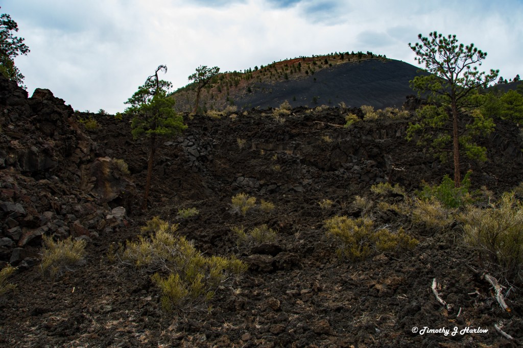
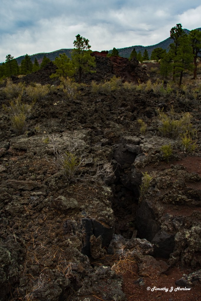
One cool thing about the Sunset Crater Monument is that there are numerous trails for exploration, but most are quite short. One can easily explore a good chunk of the monument in an afternoon. The landscape is almost indescribable. If you get a chance, take the “Lava Flow Trail” and “Lenox Crater Trails”. You’ll be right down into the heart of the immense lava flows, and looking upward at the peaks. The experience is just amazing. Many of these lava domes and fissures seem to be pouring right down onto you.
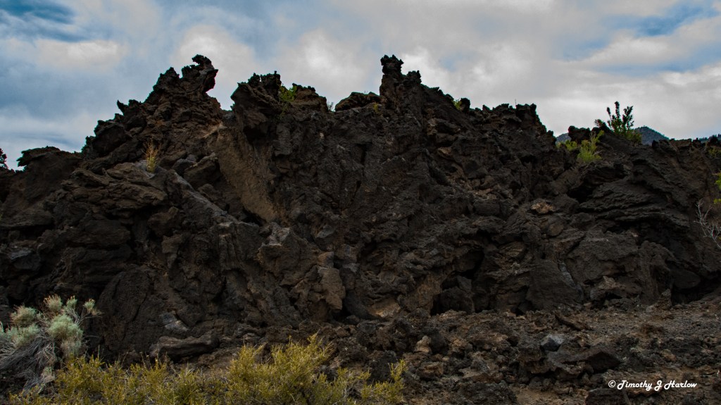
After 1000 years, much of this landscape is still nearly impossible to traverse without the trails. I was lucky to be there when there were very few others. I felt like Frodo and Sam must have felt on their trek into Mordor as they approached Mount Doom in the Lord of the Rings. It was a cloudy day, so the light was lower for much of my time there. I think this added to the aura of doom that the monument can portray. Mother Nature is always superior, and sometimes, like she did here 1000 years ago, she makes that very clear.

As I proceeded northward through the park, I caught another interesting view of Sunset Crater from a much higher vantage point. This view really shows more of the “crater” shape.

Sunset Crater is actually one part of a twin national monument. The second section, Wupatki National Monument, is north along the same park road as it eventually winds back to US 89 as that route heads north toward Cameron, Arizona. Wupatki is a collection of ancient pueblos from the indigenous peoples who were living in this area when Sunset Crater erupted.
This concludes my journey through Sunset Crater National Monument. I hope that if you are ever in this part of the American Southwest, you will take the time to visit these lands. The less than 200 miles between the Petrified Forest and Sunset Crater/Wupatki National Monuments is just packed with indescribable natural wonders. Hopefully you’ve enjoyed this tour of an incredible volcanic landscape. Next time we’ll take a look at the civilization remains at Wupatki.
Thanks again for taking time to visit my blog. Happy travels and stay safe out there.


Awesome geographic region of North America. We’re so lucky to have the opportunity to experince these locations.
On Tue, Oct 5, 2021, 4:00 PM Tim’s Viewpoints & Visuals wrote:
> Tim Harlow posted: ” The Land of Mordor* – Sunset Crater National Park * > Referring to the kingdom of the Dark Lord, Sauron, in the Lord of the Rings > Trilogy by J.R.R. Tolkien. The day after I left the Meteor Crater, I > proceeded westward on I-40/Route 66 to Flagstaff, A” >
LikeLiked by 1 person
Indeed! Hope you are enjoying the fall. Thanks for reading.
LikeLike
Enjoyed the photos and text. Love the reference to Lord of the Rings. 🙂
LikeLiked by 1 person
Thank you! I was thinking about the books while walking the trails pondering how one would get through some of the flows without those trails. Glad you enjoyed the post.
LikeLiked by 1 person
We stopped there on our 66 trip too! Such an eerie and other worldly kind of place. Mordor is a very apt comparison! 🙂
LikeLiked by 1 person
Thanks M.B.! It’s really an interesting place for sure. I went to see Mt. St. Helens in 1984, only 4 years after the eruption. It was really interesting and eerie too, especially with the huge blown down forest. But, maybe it’s all that black lava at Sunset Crater that just projects that hellishness. I kept thinking of the Lord of the Rings. Thanks for reading. Happy blogging! 🙂
LikeLiked by 1 person