


For those of you who have been following me for awhile, you may know that one of my favorite places in the desert is Capitol Reef National Park near the tiny town of Torrey, Utah. I think I am quite lucky sometimes to live in Utah as it’s home to numerous National Parks and Monuments and has some of the most incredible red rock desert in North America.
Last October, I took a trip down to Capitol Reef to do some much needed hiking and photography, and believe it or not, my wife, Sheri, came along. It’s rare that we vacation together other than at her horse shows, but it was super nice to have my best friend along. And Sheri really enjoyed herself; she got into the hiking and even took a lot of photos.
Capitol Reef NP is quite high in elevation with Torrey, Utah sitting at 6837 feet (2084 meters) above sea level. The park itself varies in elevation from a low of around 3,800 feet up to 8,200 feet (1,158-2,499 m). In October, later October when were were there, Capitol Reef gets quite cold at night. Snow and/or rain is possible. It was below freezing every night we were there as ice had formed on the rain spouts on my trailer roof. Fortunately however, we had decent but cool weather for our hikes each day.
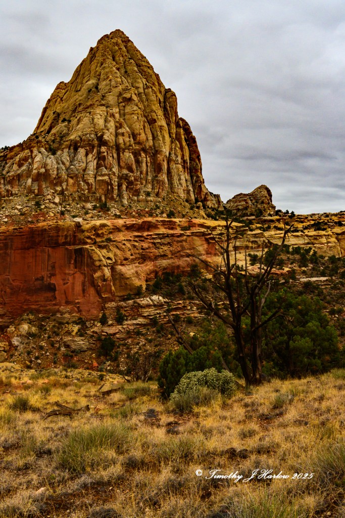
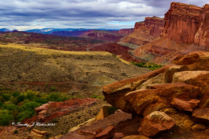
So, why do I love Capitol Reef so much? Well, first, it’s only around 200 miles (322 km) from my place in Utah. That’s an easy drive, even when towing a 30 foot camping trailer. Second, Torrey is still a tiny town with a few good restaurants and not a lot of traffic. Unless you’re in Capitol Reef in the peak of summer tourist season, the Park isn’t too crowded, and you can have some fun on the trails. Moab, just outside Arches National Park, has become a traffic nightmare, and one now needs an advance permit to even enter Arches from April through October. And third, Capitol Reef has an incredible diverse terrain – probably one of the most varied of any of Utah’s major National Parks.
Day 1 in Capitol Reef
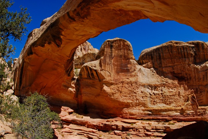
As Sheri hadn’t been to Capitol Reef since she was a kid, I spent considerable time trying to figure out some of the best trails to show her great sights. The first day we hiked up to Hickam Bridge which is a moderate trail ending at a beautiful natural bridge.
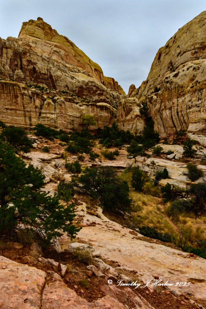
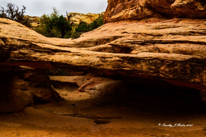
The trail into Hickam Bridge is quite varied and really interesting. It starts right off of Utah 24 and climbs quite quickly up several switchbacks to a canyon well above the highway.
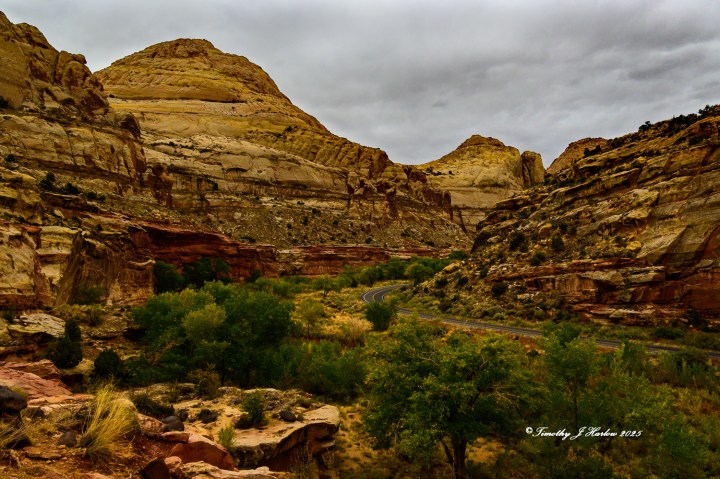
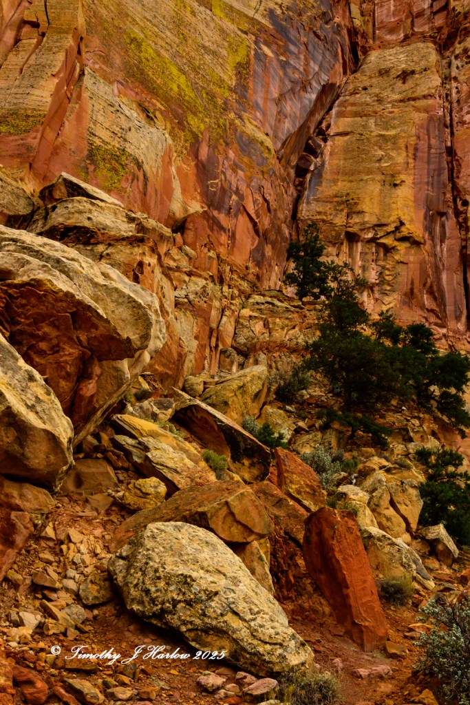
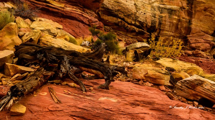
Then it winds generally westward through a canyon offering interesting and varied scenery along the way. There are white sandstone domes (thus the name, Capitol Reef), redrock and lots of greenery. The fall colors were just getting started in some of the higher areas, but the vegetation was bright due to recent rains. In fact, it had rained the night before our hike.
The trail to Hickam Bridge gives you views of grand vistas as well as closeup scenes where the walls and rocks are right up next to you. Sheri was really enjoying the scenery, the terrain and well, everything. I loved seeing her taking it all in.


As I mentioned earlier, I don’t think I could get a better photograph of Hickam Natural Bridge, so I didn’t even try. And some kids were playing around right under Hickam Bridge, making any new photo nearly impossible. I asked Sheri if she was up for more hiking, and as she said yes, we continued on the trail under the bridge.

Our trail crosses west under the Bridge and then bends southward again along a ridge that forms the top of Hickam Bridge. As you approach the southern end of the ridgeline, the trail offers some cool skyline shots and then goes back eastward, eventually connecting with the original Hickam Bridge trail.
As it was getting later, and we were both watching the western sky for rain, I didn’t really take any more photos on the return journey back to the trail head. But we lucked out as we never got rained on, and ended up having a great dinner in town at the Rim Rock Restaurant on the far east end of Torrey.
After dinner we drove back to our campground and spent the rest of the evening in our trailer with our kitties – Rocky and Adrian. Rocky has gotten to be a trailer traveling pro as he has been to several of Sheri’s horse shows with us, but this was his first trailer outing in a real campground.
Adrian, on the other hand, was only on her second trailer outing, and she seemed to think that she liked the house much better. Our two cats are hobbits – they are just not big on adventures.
Day 2 in Capitol Reef
We got out in a decent time the second morning after another rainy night, and went to the Visitors Center to see about more trail options. I really wanted to take Sheri down south on the Scenic Drive road and hike the Grand Wash Trail with a side hike up toward Cassidy’s Arch, but alas Scenic Drive was closed for serious repairs not far south of the Visitors Center .
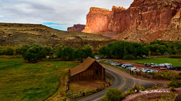
After some thinking and talks with the Rangers, we decided to tackle the Cohab Canyon Trail. The trail takes off from across the road near the Gifford House (a cool place to get cold drinks and some nice jams, etc.) and heads up the side of a big rock cliff. The first section of Cohab Canyon trail is brutal as you are walking straight up numerous, steep switchbacks until you finally hit the top, and the trail then drops a bit into the actual canyon.
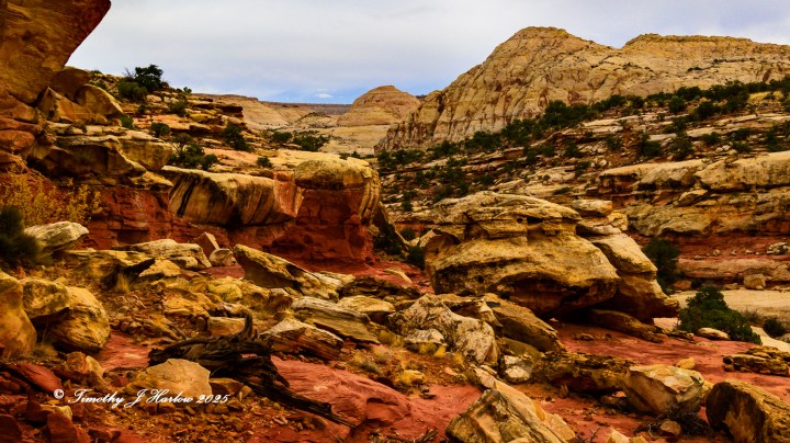
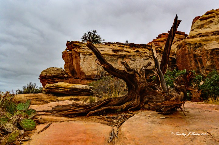
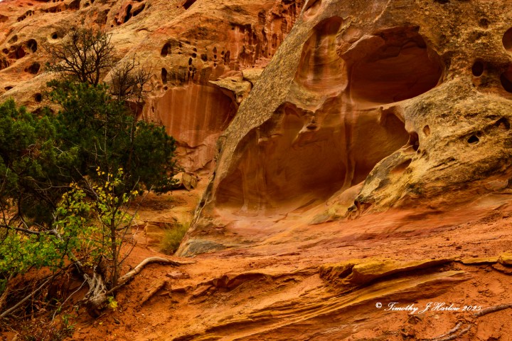
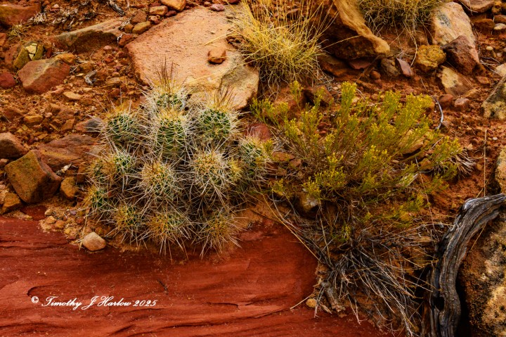
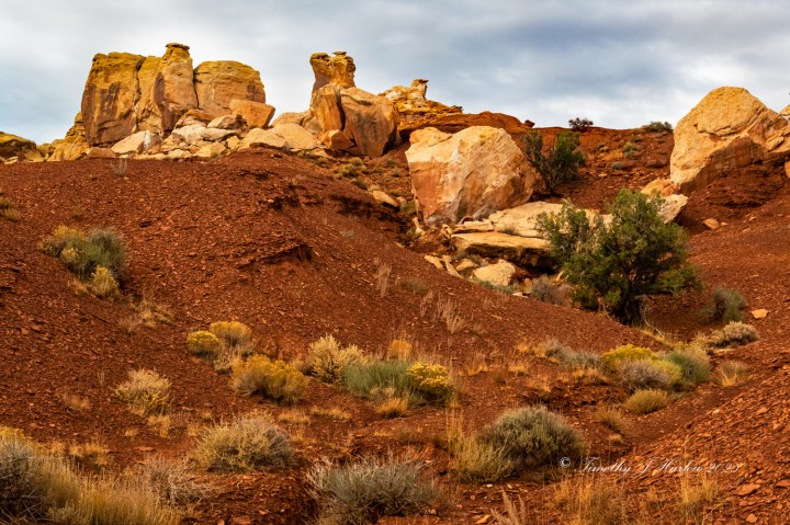
Cohab Canyon is truly beautiful. The main trail is lined with many interesting rock formations, side canyons and green trees set against the red rock formations. Every turn in the canyon brings new sites and surprises. Even though this was my second visit to the trail in the past two years, I kept seeing more new things to photograph.
As we proceeded farther into the canyon, some people we encountered coming toward us on the trail mentioned that they had seen some bighorn sheep only around 5 to 10 minutes ahead right near the trail. Sheri got really excited about this, so she went ahead of me while I finished photographing one of my still life type scenes. When I caught up to her, there were the sheep all up on the south side of the canyon.
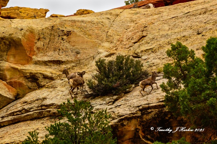
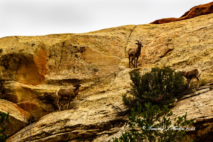
After we got some sheep photos, and after they had moved up and over the south side of the canyon, we continued onward into the canyon. The scenery kept changing as we got deeper into Cohab. Eventually the Cohab main trail comes out at a high point farther east above UT 24. The last time I hiked this trail, I did go to the end, but we chose not to do so this time as the weather started looking more threatening as the afternoon progressed.
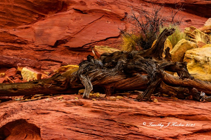
We found a cool spot to have lunch as the canyon had widened, and it was possible to climb up on the north side of the canyon well above the trail. The scenery up there is quite incredible with numerous rock formations, old trees, etc.

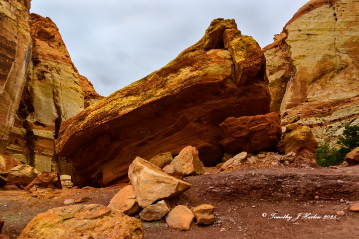
Well, after a nice trail lunch and after Sheri being patient while I took so many photos, we began to head back down the trail toward the parking area. However, we did find some more interesting features on our return hike. Sometimes just catching something from a different angle really changes the whole view.

We finally arrived back at the top of the switchbacks to head down to the parking area. I took this one last shot from the top of the trail as it entered Cohab Canyon.
I had to take one more shot as we were driving out of the Park back to catch some dinner in Torrey.
I hope after going through this post, that you can now see my fascination with Capitol Reef National Park. I have now been to the Park 4 times, and every time I see new things and become more intrigued with this part of Utah. If you are looking for a nice place to hike, camp, explore, and photograph, it’s tough to find a better place.
(To my international friends and followers who are afraid to come to the US now, I will say this. If your home country is warning you about the dangers of traveling to the US, please heed those warnings. It seems that everyday I am seeing a new story about some innocent traveler being mistreated, temporarily imprisoned or instantly deported for some unknown and fictitious reason. For this I sincerely apologize. I can only hope that sanity, wisdom and compassion can once again preside in America.)
Thanks so much for taking time to visit my blog; your support means a lot to me. Happy blogging and have fun out there!


Wow Tim, just wow.
LikeLiked by 1 person
Thank you, Leanne. I am very flattered to get a “wow” from you. I think of you as a sort of mentor, so your compliment means lot!
LikeLike
Gorgeous pictures of this park! I didn’t like Capitol Reef as much as the other parks in the area, but perhaps that’s because we got lost in there, so I hold a grudge hahaha! We owe it another chance, I think!
LikeLiked by 1 person
Oh no! But I would love to read about your experience of getting lost. You are such a great story teller; it would be awesome. So, did you all get lost on a hike, or while driving?
LikeLiked by 1 person
We got lost on a hike! We were taking one of the trails and missed a turnoff sign, and wound up strolling deep into the park in a dry riverbed. Took us quite some time to realize we’d made a mistake haha!
LikeLiked by 1 person
Oh no! I am glad that you found your way back eventually. Some of the trails are pretty primitive and not all that well marked.
LikeLiked by 1 person