


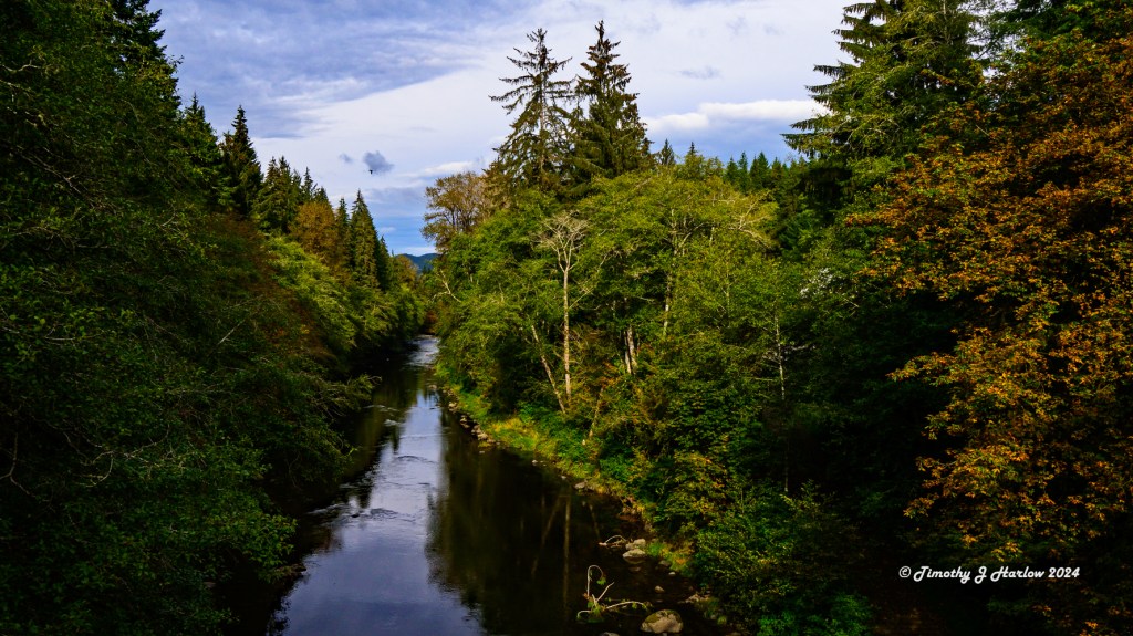
In late September and early October, I made my annual trek to the Pacific Northwest to visit my clients in Portland, Oregon and in the greater Seattle, Washington metro area. And as usual, I scheduled in some time for vacationing. When I completed my work in Portland, I drove over to Astoria, Oregon then up the Washington coast to Forks.
A couple of years ago while visiting my friend/client, Mike, in Washington, I had mentioned that I have always wanted to go to Cape Flattery – the most northwest point in the continental United States. Mike is a native Washingtonian, and he told me that it was awesome and that I should definitely make the trip one day.

So, I decided that Forks would be a good base for exploring the whole area. It’s only a few miles from some awesome rainforest, great beaches, and a reasonable drive to Cape Flattery. If any of you are sci-fi/fantasy literature buffs, you may remember that Forks, Washington is the setting for the “Twilight” vampire novels and movies. And yes, just like in the books and movies, it rains there – A LOT!
However, it is also incredibly beautiful, and there are more sunny days than the locals want to let on to us visitors. But the afternoon when I arrived it was pouring rain and really dark. The funny thing is that when I ate lunch earlier that day in Astoria, Oregon at Mo’s on the Columbia River, it was chilly, but sunny. By the way, if you want some great local seafood at a reasonable price, Mo’s is the place. Everything there is great, but the fried clams are just incredible – not tough or chewy, just really tasty.
The first morning I was in Forks, I decided to go over to Third Beach. The beach is on the coast about a 14 mile drive from Forks. Getting there requires an easy hike (around 1 mile one way) from the parking area down to the coast through the rainforest. I’ll talk more about that in my next post.
I wanted to make sure that the day I went to Cape Flattery would have good weather for nice visibility. That first morning still had a lot of overcast skies and a chance of rain.
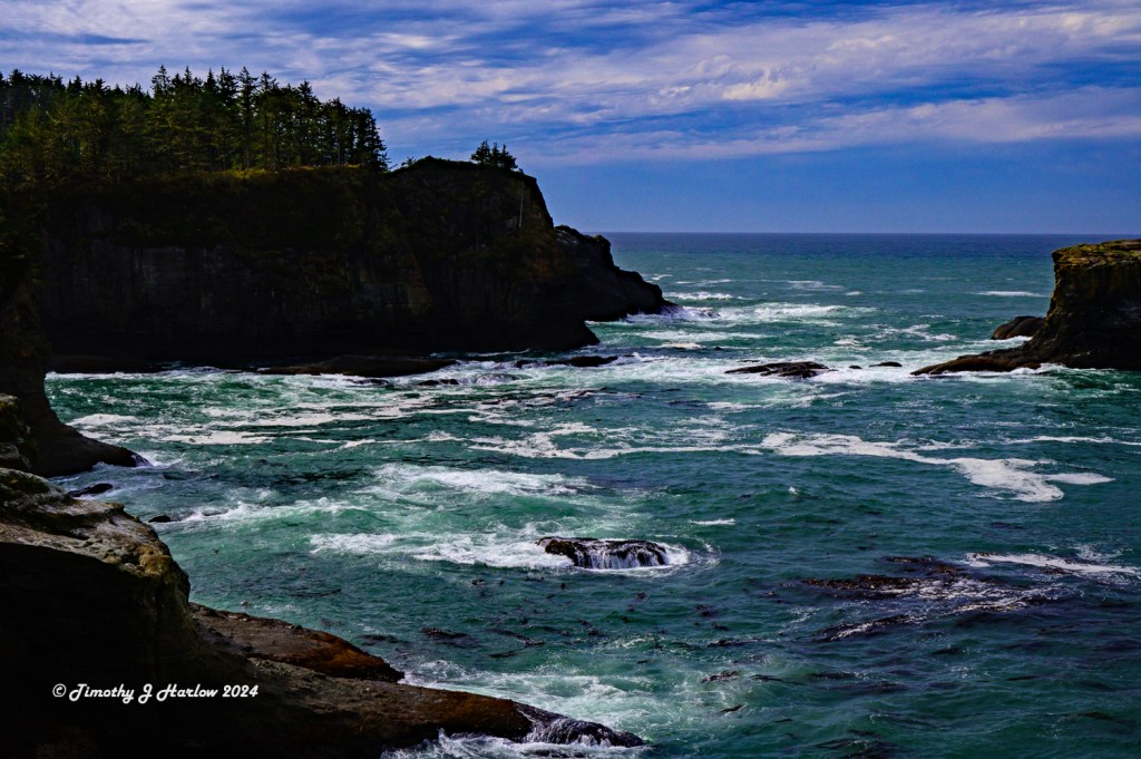
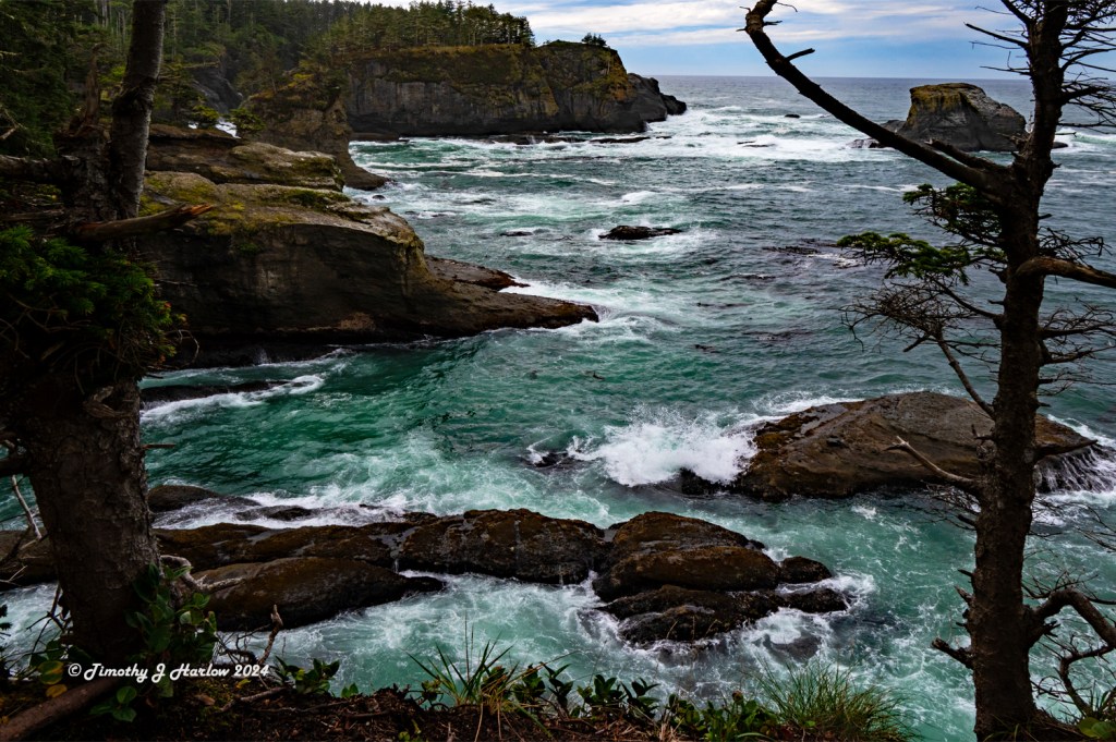
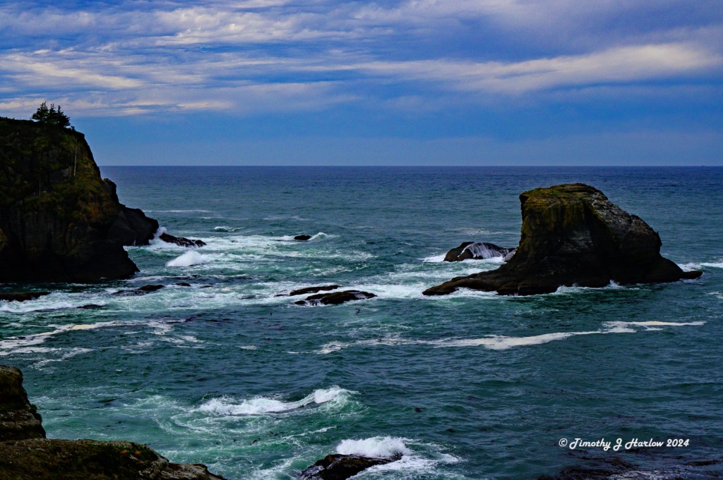
So, why is Cape Flattery appealing? Well, as I mentioned above it is the most northwestern point of the continental US. The Cape sits at the confluence of the Pacific Ocean and the Strait of Juan de Fuca which separates the United States from Vancouver Island, Canada. As as result, the entire northwestern portion of Washington state is essentially a headland. This results in some extreme storms, especially in the winter. And that violent wave action has carved some incredibly impressive scenery over many thousands of years.

Now getting to Cape Flattery is a bit of a journey from wherever you start. From Forks, head north on US 101 until the road begins to turn eastward, away from the west coast. Then continue on for a few more miles until you come to Sappho, Washington. Look for the intersection to Washington State Route 113. (It’s about 12.3 miles [19.8 km] from Forks.) Turn north on SR 113, and continue north until you reach the intersection with WA SR 112. Stay straight, and the road becomes WA SR 112.

State Route 112 eventually hits the coast on the north end of the Olympic Peninsula. Keep following SR 112 west along the coast until you reach Neah Bay. This is the last town before Cape Flattery. Look for Cape Flattery Road at the far west end of Neah Bay. The road winds around toward the south and finally approaches Cape Flattery from the south.
Cape Flattery is about 57 miles (91.7 km) from Forks, but this is not a fast drive. The roads are narrow; the terrain is very mountainous, and SR 112 along the Washington coast is really twisty and windy. It takes at least 1-1/2 hours due to the terrain; however, the drive is really beautiful. And on SR 112 along the coast, you’ll see Vancouver Island if the weather is good as well as other cool scenery.
The Cape is on the Makah Reservation. In fact, the closest town, Neah Bay, is also part of the Makah Reservation. To visit the Cape, you’ll need to get a permit in town at Neah Bay. The permit is per vehicle and is $20. It must be displayed in your vehicle while parked anywhere on the Makah reservation while hiking, sightseeing, etc.

The first documented non-indigenous person to see the Cape was Captain James Cook on March 22, 1778. He wrote in his journal, “… there appeared to be a small opening which flattered us with the hopes of finding an harbour … On this account I called the point of land to the north of it Cape Flattery.” (From Wikipedia). In fact, Cape Flattery is the oldest, non-native named feature in Washington.


The Cape Flattery Lighthouse was decommissioned in 2008 after the Coast Guard had erected a 30 foot tall tower with solar-powered light. The lighthouse was supposed to be cleaned up, restored, and then turned over to the Makah Tribe, but there has never been enough funding to do so.

I spent quite a bit of time at the Cape, and hiked to all of the viewpoints. The sound of the waves was really enchanting and soothing. Just staying still, listening to the surf and watching the waves is really mesmerizing for me. And, for an early October day, the weather was fantastic. If you go, the Washington coast can be quite cool, even in the summer, so it’s a good idea to have light jacket handy. The temperatures that day were in the low 50s F (11˚ to 12˚C) with a breeze at the overlooks.

After leaving Cape Flattery, I went back to Neah Bay and had some lunch at The Warm House that is right on the water. The food was very tasty, and the service great. The waitress was really friendly; she told me about the Makah Museum that was just down the road a block. If you have time I would highly recommend the museum. It takes you through a thorough history of the area and the Makah people. And the museum even has a “Makah Longhouse” inside. The museum has a lot of Makah artifacts including their dugout canoes and their handcrafted boxes, which were just amazing.
This just about wraps up my trip to Cape Flattery, Washington. My friend, Mike, was right; this place is amazing! The scenery here is magical. Neah Bay was an interesting little town. The Makah museum was really fascinating; I spent more time there than I planned. But it was so fun to learn more about the native culture, and the the intimate ties between the Makah people, the sea and the natural world.
A few things I would recommend to anyone contemplating a visit, would be to:
- Check the weather forecast for the day. You really want to be able to see things well.
- Make sure you get your tribal visitation permit in Neah Bay BEFORE heading to the cape.
- Don’t skimp on time here; give yourself most of the day – you’ll be glad you did.
- Respect the Makah people; this is their home and their land.
I really hope this post helped you to get an idea what it’s like at the northwestern tip of the United States, and I hope this inspires you to come for a visit. It’s a really spectacular place!
Have fun out there, and thanks for taking time to visit my blog.


Nature is certainly our finest artiste!
LikeLiked by 1 person
She is indeed. There are so many wonderful places in our world.
LikeLiked by 1 person
A hidden gem indeed, Tim.
LikeLike